8622-6 Marlo Plains
|
This information has been developed from the publications:
|
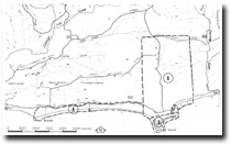
Location: | 518200/520135 to 535200/535153. This is an area adjacent to the Cape Conran – Cabbage Tree Road. | |
Abstract: | Pleistocene dunes – ridges and swamps. | |
Access: | Cape Conran – Cabbage Tree Road. | |
Ownership: | Private land west of the road, Crowm Land to the east. | |
Geology: | Pleistocene dune sands and Tertiary sands and minor gravels. | |
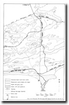
Geomorphology: | East of Snowy River on the Marlo Plains is a distinctive patter of broad sand ridges with a forest and woodland cover alternating with grass and heath plains which are in places swampy or contain small lakes. This terrain occupies a belt over 40 kilometres long and up to six kilometres wide parallel to the coastline. The belt contains two major Pleistocene dune sequences, the older resting on a higher terrace surface from a younger Pleistocene group on a 20+ metre terrace by a continuous well-defined ridge up to 50 metres high. This ridge has accumulated on and obscured the scarp that separates the two terraces. The sands are deeply leached and contain a well-defined dark brown iron-stained and firmly cemented B horizon up to two metres thick which grades into the parent material of pale to yellow-brown quartz sand. The sand ridges are remnants of dunes formed by strong and unidirectional winds from the south-east. They represent an advanced stage of deflation of sandy terrain and contrast markedly with the well preserved parabolic dunes of the younger coastal barriers, or at Point hicks. The Marlo Plain dunes may be of similar origin to the sandy deposits of the East Sale Plain and Monro Plain north of the Gippsland Lakes. Detailed investigation of soils and degree of weathering would allow comparison and correlation with these other areas. | |
Significance: | State. The area has much to contribute to an understanding of Pleistocene environments in southern Victoria. It is the least disturbed area of such terrain in eastern Victoria. | |
Management: | Extensive clearing and draining of the ridge and swamplands reduces the value of the site for studies of landform, soil and vegetation associations. Priority should be given to minimising the disturbance to the land east of the Cape Conran to Cabbage Tree Road. | |
References: | Rosengren, N. J. 1978. The Physiography of Coastal Dunes, East Gippsland, Victoria. M. A. Thesis (Unpub.), University of Melbourne | |
 Older dune topography - Marlo Plains |


