8524-8 Native Dog Flat
|
This information has been developed from the publications:
|
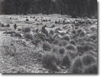
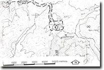
Location: | 970160. Seven kilometres south-west of Mount Cobberas No. 1. |  Native Dog Plain. Restricted outcrops (arrowed) of limestone lens in Cowombat Siltstone. |
Abstract: | Exposures of limestone lens and fossiliferous shales of Cowombat Siltstone. | |
Access: | Limestone Road, (Black Mountain Road). | |
Ownership: | Crown Land. | |
Geology: | Road cutting along Limestone Road display the range of rock types included in the Thorkidaan Volcanic Group. Phyolites predominate although ryhodacites are not common. The Volcanics are quite variable in appearance, but most contain phenocrysts of embayed quartz, altered felspar and occasionally biotite. Interculations of tuff are rare although a large ruff band outcrops near the head of Painter Creek. This shows prominent reverse grading suggesting that the tuffs are waterlain tuff ash full deposits. The reverse bedding is due to the delayed settling of the larger vesicular fragments due to the slowness with which they became waterlogged. At this locality, poorly exposed, although richly fossiliferous shales and several small lenses of limestone of the Cowombat Siltstone outcrop. There is a rich coral and conodont fauna at this site including Fletcheria, Mucophyllum, Propora, and Favosites, and is approximately equivalent stratigraphically to the fossiliferous horizons occurring at Cowombat Flat. It has been suggested that Native Dog Plain is the focus of a number of faults, which have produced inter alia, contorted marbles. However, later investigators indicate that the faulting hypothesis is not supported by stratigraphic evidence. | |
Significance: | Regional. Type site of the extensive Thorkidaan volcanics. Local. The area provides further evidence of the stratigraphic position of the Cowombat Siltstone. | |
Management: | Maintenance of clear exposures in the road cuttings would enhance the quality of the site. Limited quarrying of a small part of the limestone deposits would increase the available fossil outcrop. Such quarrying should be located to avoid disturbance to drainage to the Buchan River tributaries. | |
References: | Vandeberg, A.H.M., Bolger, P., O'Shea, P.J. 1980. (in press) 'Geology and Mineral Exploration of the Limestone Creek-Reedy Creek Area, North-East Victoria', Geol. Surv. V. McAndrew, J. and Marsden, M.A.H. (eds) 1973. Regional guide to Victorian Geology. Second Edition, School of Geology, University of Melbourne. Douglas, J.G. and Ferguson, J.A. (eds) 1976. Geology of Victoria Geological Society of Australia, Special Publication No. 5. | |


