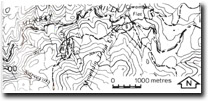
8524- 6 Cowombat Flat
|
This information has been developed from the publications:
|
Location: | 045270. Four kilometres north-east of Mount Cobberas No. 2. | |
Abstract: | Limestone lens in Cowombat Siltstone. | |
Access: | Cowombat Flat Track (Tin Mine Road). | |
Ownership: | Crown Land. | |
Geology/Geomorphology: | A richly fossiliferous limestone lens outcrops in the headwaters of the Murray River at Cowombat Flat. The exposures on the Victorian side of the border are generally poor, being obscured by regolith and slope wash sediments. The extent of the limestone is marked by several small sinkholes. | |
Significance: | Local. The limestone outcrop provides an additional fossil site which is of importance in determining the stratigraphic sequence of the Silurian sediments. | |
Management: | The outcrops in Victoria is limited, and extensive and uncontrolled collection of fossils would degrade the site. | |


