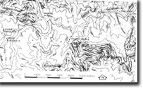
8523-40 Deddick Park Area
|
This information has been developed from the publications:
|
Location: | 260930. 4 kilometres north-west of Mt Deddick. | |
Abstract: | Silver lead mineralization associated with quartz reefs in Lower Silurian granitic rocks. | |
Access: | Deddick Track. | |
Ownership: | Crown land (Snowy River National Park). | |
Geology: | Lower Silurian granitic rocks in hornblende are intruded by feldspar porphyry, mica diabase dykes and quartz ribbon veins. The latter are associated with silver/lead mineralization. | |
Significance: | Local. | |
Management: | This is an old mining area and good collectors specimens may be obtained but control on excavation and removal of material is necessary. The area could be displayed as a site of historical and geological interest. | |
References: | Stirling, J. 1899a. 'Further report on the geological survey of Mount Deddick silver-lead field', Mon. Progr. Rep. geol. Surv. Vict., 4 and 5 :3-5. Ferguson, W.H. 1899. 'Report on silver-lead deposits, Murrindal River', Monthly Prog. Rep. Geol. Surv. Vict., Nos. 4 and 5 :19-20. Ringwood, A.E. 1955a. 'The geology of the Deddick-Wulgumerang area, East Gippsland', Proc. R. Soc. Vict., 67 :19-66. Porritt, K. 1978. The geology of the Freestone Creek Area, Victoria.. Honours Thesis (unpub.), Department of Geology, Monash University. | |


