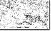
8523-39 Turnback Peak
|
This information has been developed from the publications:
|
Location: | 235952. 2 kilometres west of Mackillop Bridge. | |
Abstract: | Pre-basaltic gravels containing leaf impressions and a graptolite fossil site in Ordovician sediments. | |
Access: | Turnback Track. | |
Ownership: | Crown land. | |
Geology: | At Turnback Peak, high level river gravels underlie Tertiary Older Basalt. These contain materials up to boulder size as well as some layers of fine grained material within which leaf impressions occur. Ordovician sediments outcrop to the east of the peak and these contain occasional poorly preserved graptolites. | |
Significance: | Local. | |
Management: | The site could be degraded by over-collection of fossils or quarrying and alluvial mining of the pre-basaltic sediments. | |
References: | Ferguson, W.H. 1899. 'Report on silver-lead deposits, Murrindal River', Monthly Prog. Rep. Geol. Surv. Vict., Nos. 4 and 5 :19-20. | |


