8523-32 Little River and Boundary Creek Gorge
|
This information has been developed from the publications:
|
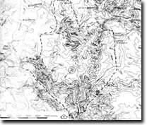
Location: | 180930. Little River Gorge is 15 kilometres east of Wulgumerang, and Boundary Creek Gorge is 7 kilometres south-east of Wulgumerang. |  Little River Gorge. |
Abstract: | Spectacular river gorges cut in Snowy River Volcanics. | |
Access: | Wulgulmerang - Deddick Road and Little River Track. | |
Ownership: | Predominantly Crown land (part Snowy River National Park). | |
Geology: | Upper Devonian - Lower Silurian granodiorite is exposed in the lower sections of Little River. Small areas of granite are included in the main intrusion, and several massive aplite dykes occur in the vicinity of the contact with the Snowy River Volcanics. The Snowy River Volcanics unconformably overly the granodiorite. The volcancis consist predominantly of rhodamines with intercalations of latites, sediments and pyroclastic which have been folded along north-south axes. The Snowy River Volcanics have been divided into five formations, Boundary Creek Conglomerate, and Wulgulmerang Tuffs. All these formations are well exposed in the Little River Gorge and Boundary Creek Gorge. The Deddick Rhyodacite constitutes the basal member of the Snowy River Volcanics and attains a maximum thickness of approximately 1000 m in the Little River area. Petrographically this formation has been divided into the types: a strongly porphyritic light coloured rock containing phenocrysts of quartz and feldspar up too 5 mm long, and a rock of finer texture containing occasional small phenocrysts of quartz and feldspar texture containing occasional small phenocrysts of quartz and feldspar generally less then 2 mm in diameter. These types, together with transitional varieties, are interbedded with thin sedimentary beds and a latite flow. Overlying the Deddick Rhyodacite is the Black Mountain Rhyodacite. This latter formation is exposed in the Little River Gorge and reaches a thickness of approximately 800 m. It is similar in hand specimen to the Deddick Rhyodacite being strongly porphyritic with phenocrysts of quartz and feldspar up to 5 mm in diameter. A black grassy groundmass distinguishes this rock from the Deddick Ryodacite. Gelantipy Rhyodacite overlies the Black Mountain Rhyodacite and reaches a thickness of approximately 900 m in the Little River Gorge, and is possibly thicker to the south in Boundary Creek. In thin section the Gelantipy Rhyodacite is seen to be similar to the Black Mountain Rhyodacite and is distinguished from the latter by the almost complete absence of ferro-magnesium phenocrysts. However, because of secondary alteration, the hand specimens display a wide variety of appearance and recognition of the rock in the field is often difficult. Interbedded with the Gelantipy Rhyodacite are tuffs and rhyodacite conglomerates. These materials become predominant toward the top of the sequence where they overly the Gelantipy Rhyodacite. The basal part of this formation is characterized by very coarse conglomerates with clasts reaching 0.5 m in diameter. The clasts are composed predominantly of Gelantipy Rhyodacite although occasional pebbles of granodiorite, slate, sandstone and other types of rhyodacite occur. The clasts are partly rounded and often display a partial stratification as the long axes of the components are orientated parallel to each other. These conglomerates are well exposed at the head of the Boundary Creek Gorge where the conglomerate matrix has become silicified producing a hard, erosion resistant rock. The Conglomerates become progressively finer toward the top of the sequence where they grade into the Wulgulmerang Tuffs. However, coarse conglomerate lenses and thin rhyodacite flows occur in the tuffaceous material. The tuffs are generally light coloured and fine grained and often exhibit well developed bedding. A latite flow is interbedded with the tuff and this flow is exposed in the Wulgulmerang Creek and Little River. The tuffs have been folded and the latite in outcrop forms a double “S” shape. | |
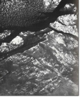
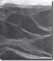
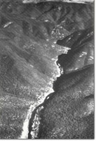
Geomorphology: | The major geomorphologically features of the area are the gorges and waterfalls of the Little River and Boundary Creek. These features have resulted from rapid down cutting of the river channels to the local base level of the Snowy River. The gorges have been cut through the Snowy River rhodamines and the main nick points are now in the resistant strata of silicified gravels of the Boundary Creek conglomerate. The resultant over steepening of the valley walls produces active mass wasting such as occasional rock falls and landslides. This has been facilitated by the intense fracture pattern developed in the rhodamines. The Little River falls approximately 700 m in 4 kilometres through a gorge with cliffed margins often reaching heights of 500 m. Falls and rapids are frequent as tributary valleys are often perched many hundreds of metres above the Little River and Boundary Creek channels. A most spectacular example is that of the Wulgulmerang Creek which plunges into Little River Gorge over falls 300 m in height. The change in lithologies from the Snowy River Volcanics to the more easily eroded granite and granodiorite in the lower section of the Little River is associated with a distinct contrast in valley morphology. In this are the precipitous nature of the gorge gives way to relatively low gradient valley side slopes. | |
Significance: | National. The gorge development on the Little River and Boundary Creek and the resultant rugged and precipitous terrain is unrivalled, except by the Tulloch Ard section of the Snowy River, elsewhere in Victoria. Additionally, the gorges provide the most comprehensive exposure of the five formations comprising the Snowy River Volcanics. | |
Management: | The considerable scientific and scenic value of the site would be destroyed if flooding of the gorges if major reservoir construction were permitted. Further, the spectacular scenic values of the site could be seriously downgraded by placement of artificial structures such as roads and bridges or by land clearing and forestry operations that transgress on the visual catchment obtained from the major vantage points around the rim of the gorges. | |
References: | Ringwood, A.E. 1955a. 'The geology of the Deddick-Wulgumerang area, East Gippsland', Proc. R. Soc. Vict., 67 :19-66. Ringwood, A.E. 1955b. 'The geology of the Snowy River District, East Gippsland', Ibid. 67 :67-74. | |
 Boundary Creek Gorge. |  Snowy River Gorge, north of Campbell Knob. |


