8522-3 River Mouths - Ewing Marsh
8522-3, 4 Ewings Marsh (Barrier and Lagoon)
This information has been developed from the publications:
|
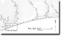
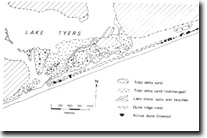
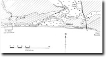
Introduction: | A dune capped sand barrier formation extends for over 50 kilometres between Red Bluff near Lake Tyers and Point Ricardo east of Marlo, enclosing a complex of swamps and lagoons and blocking or diverting the mouth of several streams including the Snowy River. Behind the lagoon is a clearly defined bluff, a former sea cliff which marks the edge of a coastal terrace eroded in Tertiary marls, limestones and sandstones. In broad detail the barrier-lagoon-bluff system is analogous with that of the Ninety Mile Beach and lakes of the Gippsland Lakes region. | |
Location: | 078135 (Hospital Creek); 125145 (Hartland River); 184154 (Dinner Creek); 205160 (Simpson Creek). All approximately 6 kilometres south of Princes Highway. | |
Abstract: | Swamp filled stream outlets into Ewing Marsh. | |
Access: | Montos Road (Hospital Creek); Irish Waterholes Road (Hartland River); Wombat Track (Dinner Creek); Beach Road (Simpson Creek). | |
Ownership: | Crown land. | |
Geology: | The valleys are incised in Jemmys Point formation beds and younger Pliocene non-marine sands and gravels. Outcrops are limited. | |
Geomorphology: | The four main streams that flow into Ewing Marsh have small catchments that drain across the distinctive Piedmont Downs landscape east of Lakes Entrance. The streams are incised in their lower reaches into a well defined coastal terrace 15 to 20 metres above sea level but the stream mouths differ from others in East Gippsland in that they are completely and permanently enclosed by the Ewing Marsh barrier and have no tidal connection and estuarine sector. The valley floors have become almost completely filled with a dense freshwater swamp of reed, sedge and swamp scrub, and only Hospital Creek maintains an open channel into Ewing Marsh. | |
Significance: | Regional. The streams contrast markedly with the small estuaries and estuarine lagoons developed at the mouths of comparable streams in East Gippsland. The stratigraphy of the deposits in the valleys has not been investigated, but the sites should contribute substantial data on the chronology of barrier emplacement here. | |
Management: | Minimal disturbance to the lower stream is necessary to maintain physiographic and related ecological features. | |
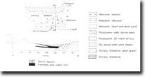
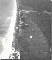 Ewing Marsh. Barrier (A). Infilled lagoon (B) |


