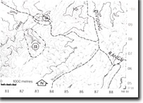
8424-13 Gibsons Folly Sediments
|
This information has been developed from the publications:
|
Location: | 825080. Tributary of the Tambo River bounded by Tea Pot Creek Track and McDougal Spur Track. | |
Abstract: | Type section for Gibsons Folly Formation. | |
Access: | Tea Pot Creek Track. | |
Ownership: | Crown Land | |
Geology/Geomorphology: | Down cutting by the small tributary of the Tambo River at this location has exposed a section in the Silurian Gibson Folly Formation. This formation is of importance as it is associated with the recently discovered copper-silver-lead-zinc deposits. The type section consists of strongly foliated rhyodacites interbedded with marine slates with an additional andesitic flow, which outcrops near the junction of the tributary and the Tambo River. | |
Significance: | Regional. Type-site in generally poorly exposed Gibsons Folly Formation. | |
Management: | Access to the site should be maintained and may need to be formalised with any further land holder. | |
References: | Vandenberg, A.H.M. and O’Shea, P.J. 1980. 'Explanatory Notes on the Bairnsdale 1:250,00 geological map', Rep. geol. Surv. Vict., No.65. | |


