8323-7 Dargo
|
This information has been developed from the publications:
|
Location: | 240550. Area to the north and east of Dargo. | |
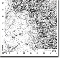
Abstract: | Weathering and erosion basin formed on granite, metamorphic aureole ridge. | |
Access: | Dalmore Road and Jones Road. | |
Ownership: | Private land. | |
Geology: | Ordovician sandstones and quartzites have been metamorphosed to horn felsic rocks by the intrusion of granite in the Dargo area. | |
Geomorphology: | The granites are deeply weathered and stream erosion has given rise to a large area of negative relief enclosed within an erosion resistant contact metamorphic ridge. The granite basin is gently undulating and in marked contrast to the steep slopes of the contact metamorphic ridge which rise to 400 m. The Dargo River has developed wide alluvial flats over the weathered granite. | |
Significance: | State. The Dargo granite basin is an outstanding example of an etched landscape and comparable to such classic sites as the Murmungee Basin in north-eastern Victoria. | |
Management: | Because of the area covered by the site the value of the significant geomorphological features would not be seriously reduced by localised land disturbance, e.g. road works or extractive industries. | |
References: | Ollier, C.D. 1962. Weathering. Oliver and Boyd, Edinburgh. | |


