8223-4 Snow Bluff, Mt Kent, Moroka Gorge
|
This information has been developed from the publications:
|
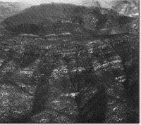
Location: | 926640 - 965550. Approximately 65 kilometres north of Maffra. The area lies between the Moroka and Wonnangatta Rivers. |  Snowy Bluff Syncline in Avon river Gorge. |
Abstract: | Extensive outcrops of Ordovician and Upper Devonian - Lower Carboniferous sedimentary and volcanic rocks. High cliffs, gorge and steep valley slopes. | |
Access: | a) Crooked River/Wonnangatta Road to Eaglevale Station and Moroka Glen. b) Moroka Road to Mt Kent. c) Moroka River - 4WD track. Extensive overland hikes are necessary to examine the major outcrops n Snowy Bluff and along the Moroka River. | |
Ownership: | Crown land. | |
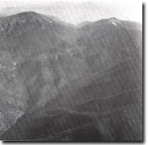
Geology: | The area contains major exposures of Upper Devonian - Lower Carboniferous sedimentary and volcanic rocks of the Mt Howitt Province. The rocks occur in the Avon Synclinorium and in this area have been folded into three main north-south trending structures of variable plunge - Cromwells Knob Anticline flanked to the west by the Snowy Bluff Syncline on to the east by Mt Kent Syncline. Erosion by the Moroka and Wonnangatta river system has resulted in massive escarpments and deep gorge sectors with extensive outcrop of the Avon River Group materials. The oldest rocks (Ordovician) occur in the lower reaches of the Moroka River and along the Wonnangatta River and are well exposed in river cliffs near the confluence of these streams and near Eaglevale Station. They consist of steeply dipping solidified sandstones and slates which on the basis of a sparse fossil evidence have been assigned to Upper Ordovician. Minor folding and flexuring of these beds can be seen along the Wonnangatta River. The Avon Group unconformably overlies the Ordovician rocks and this contact is evident along the lower slopes of Snowy Bluff and Mt Kent on the Wonnangatta Valley. The Avon Group is a thick sequence of Upper Devonian acid volcanics contained within Upper Devonian - Lower Carboniferous non-marine sediments. Extensive basalts also occur throughout the Avon Group. The varied lithologies of the Ordovician and the Avon Group may be observed in a traverse extending from the junction of the Moroka and Wonnangatta rivers to the top of Snowy Bluff as this traverse crosses some of the major escarpments is characterized by conglomeratic beds ranging from boulder conglomerate to pebbly sandstone. The composition of these sediments indicates derivation from the Ordovician sediments. Extensive exposure of the Moroka Glen Formation occurs also along the Moroka River south of Snowy Bluff in the eroded core of Cromwells Knob Anticline. The Moroka Glen Formation is conformably overlain by the Wellington Rhyolite Formation containing distinctive porphyritic and flow banded rhyolite. Although consisting of several flows with interbedded sediments, the volcanics are considered to represent one major phase of eruption. Jointing of the rhyolite forms prominent escarpments on Snowy Bluff and Mt Kent. The major escarpments in the area occur in the next formation, the Mt Kent Conglomerate which includes thick basalt flows which are especially prominent on the northern slopes of Snowy Bluff. The basalts show considerable alteration and a particular feature of these is the extensive deposition of secondary minerals (chalcedony, quartz, carbonates) in joints and amygdales. The distinguishing feature of the Mt Kent Conglomerate is the extensive nature of pebbles found throughout the formation. The Mt Kent Conglomerate is distinguished from the overlying Snowy Plains Formation by the generally finer grain size of the sandstone and absence of pebble conglomerates in the latter. Both formations have a reddish-purple sandstone and shale as prominent beds. | |
Geomorphology: | The area includes high erosion escarpments, extensive scree slopes, deeply dissected valleys and narrow alluvial sections on the Moroka and Wonnangatta rivers. The major cliffs are on the northern sides of Snowy Bluff and Mt Kent but there is extensive outcrop over the entire area. The Moroka River has cut a deep gorge south of Mt Kent into the Mt Kent Conglomerates upstream from Fitzpatricks Creek. Below here, the valley sides are less precipitous and include short alluvial sections with high level gravel terraces up to 3 m above the present flood plain. There is marked contrast between the steep valley slopes of the Moroka River on the Avon Group sediments and the wider, alluvial down-stream sections where it crosses Ordovician sediments and joins the Wonnangatta. | |
Significance: | State. The area contains type sections and major exposures of the Avon Group. A wide range of structures and lithologies is exposed in escarpments and valley sides and the Snowy Bluff Syncline can be clearly seen from the Moroka Jeep Track. The area illustrates clearly the characteristics of the Upper Devonian - Lower Carboniferous rocks of east central Victoria on both macro and micro scales. | |
Management: | Flooding of the Moroka Valley by reservoir construction would destroy geomorphological features and obscure important geological sections. Roads or transmission lines across the face of Snowy Bluff and Mt Kent would be discordant with the geomorphologically significant patterns produced by folding of the Avon River Group sediments and volcanics and reduce the value of the site. | |
 Eroded Core of Cromwell Knob Anticline |


