
Soils and Landforms of South-Western Victoria
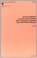 |
Soils and Landforms of South-Western Victoria (PDF 1227 KB) Soils and Landforms of South-Western Victoria (DOC - 2281 KB) To view the information, PDF requires the use of a PDF reader. This can be installed for free from the Adobe website (external link). Click on the links below for specific information on the Soil and Map Unit descriptions Generalised Soil Descriptions Map Unit Descriptions |
© State of Victoria (Agriculture Victoria) 1996 - 2025.

This work, Victorian Resources Online, is licensed under a Creative Commons Attribution 4.0 licence. You are free to re-use the work under that licence, on the condition that you credit the State of Victoria (Agriculture Victoria) as author, indicate if changes were made and comply with the other licence terms.
The licence does not apply to ‘branding’ or some ‘images or photographs’ that may be owned by third parties. We ask you to seek prior approval to use images using the VRO feedback form. Access to higher quality images can also be provided on request.
This page was last updated on 23/03/2020.