
16.1 Sandy Creek
|
This information has been developed from the publications:
|
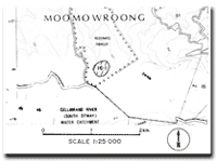
| Location: | 16-085200. Three kilometres north of Stalker. | |
Access: | Mt McKenzie Road. | |
Ownership: | Crown land (Reserved forest). | |
Geology: | The site has not been located in the field but aerial photograph interpretation suggests it is an outcrop of Cretaceous sediments on a slope above Sandy Creek. | |
Significance: | Regional. Outcrops of this extent are uncommon in the Otway Ranges. | |
 Site 16.1 |
© State of Victoria (Agriculture Victoria) 1996 - .

This work, Victorian Resources Online, is licensed under a Creative Commons Attribution 4.0 licence. You are free to re-use the work under that licence, on the condition that you credit the State of Victoria (Agriculture Victoria) as author, indicate if changes were made and comply with the other licence terms.
The licence does not apply to ‘branding’ or some ‘images or photographs’ that may be owned by third parties. We ask you to seek prior approval to use images using the VRO feedback form. Access to higher quality images can also be provided on request.
This page was last updated on .