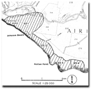
23.3 Rotten Point
|
This information has been developed from the publications:
|
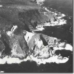
| Location: | 22-085046. Two kilometres west of Glenaire. |  Cliff-top blowouts (arrowed) at Rotten Point. |
Access: | Track off Great Ocean Road. | |
Ownership: | Crown land (Otway National Park). | |
Geology/Geomorphology: | Mesozoic sandstones are here deeply weathered into an intricate fretwork pattern (tafoni) including some larger examples of cavernous weathering. The westernmost headland of the point is littered with weathered fragments that are strongly discoloured by ferruginous enrichment. The unusual weathering details may in part be related to the influence of the overlying Rotten Point Sand which caps this headland and the one immediately to the east. The uncomfortable contact between the Mesozoic rocks and the Rotten Point Sand occurs high on the headland. There is a sea cave on the west of Rotten Point. Younger wind blown sands also cap Rotten Point, and two trough blowouts have developed, aligned east-west in response to predominant winds. Numerous shells and small tools lie in the main trough including several made from quartzite and flint. | |
Significance: | State. The Mesozoic-Tertiary relationship on and adjacent to Rotten Point are important in determining the structures and depositional history of the Johanna and Aire districts. The intensity of tafoni weathering forms at such height above the sea is unusual. The two "perched" blowouts are unusual examples of cliff top dunes. | |
 Weathering of Mesozoic sandstone at Rotten Point. |


