11.1 Lake Elizabeth and Landslide
This information has been developed from the publications:
|
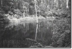
Location: | 11 - 400291. Five kms southeast of Forrest. |  Small lake in back-tilt block above Lake Elizabeth. |
| Access: | (a) Kaanglang Road (Access road to Barwon River and walking track to outlet of lake). (b) Thompson Track (Access Track to head of lake). | |
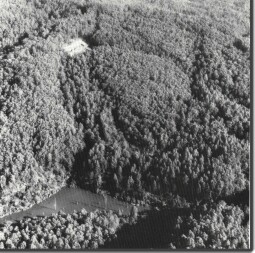
| Geomorphology: | Lake Elizabeth formed when a landslide blocked the East Branch of the Barwon River on 17th June, 1952. Originally the lake extended for 1.6 km upstream from the landslide dam and by 8th August 1952 water over-topped the landslide and flowed down a natural spillway. Twelve months later (5th August 1953) following heavy rains, the top 26 m of the landslide dam breached and a surge of water carried gravels and boulders several kilometres downstream. The residual dam now contains a lake about one fifth the original volume. The new river channel created by the August 1953 surge is straighter than the original course and is flanked by a levee and terrace of gravels and boulders left by the receding flood. | |
| Although now mainly reforested, parts of the landslip surface are now gullied and smaller slips continue to develop on the debris surface. Approximately 30 metres above the main lake is a smaller lake and swamp formed in a back tilted section of the original slide surface. | ||
| Significance: | National. The site is a classic example of a newly formed landslide blocked lake and a number of geomorphological features represent the drainage adjustments upstream and downstream from the landslip. Because the date of the slide is known, it forms a model whereby geological, hydrological and meteorological factors relevant to landslide analysis in the Otways area may be studied. Rates of sediment accumulation in the lake and adjustments in the river profile below the dam are other major fields of geomorphological interest at the site. | |
| References: | Currey, D. T. (1952). "Landslide on the East Barwon." Aqua 3. p.18. Knight, R. G. (1953). "Landslide Lake - East Barwon at Forrest. Breaching of natural dam." S.R.W.S.C. Vict. Evans, R. S. (1973). "Slope stability studies in Victoria with special reference to the eastern Otway Ranges." | |
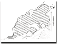
 The landslide dam that blocks the Barwon River to form Lake Elizabeth. |  Map of Lake Elizabeth. |


