
9.5 Gellibrand "Shale Pit"
This information has been developed from the publications:
|
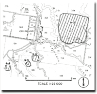
| Location: | 9-207307. Two kilometres south of Gellibrand on the eastern slope of Charley Creek Valley. | |
Access: | Off the Gellibrand-Beech Forest Road. | |
Ownership: | Private land. | |
Geology: | This is a quarry, now seldom worked, from which tough fractured rock described as shale by Kenny (1938) was extracted for use as ballast on the Colac-Beech Forest railway. Darragh and Bowen (1965) interpreted the material as altered volcanic rock (kaolinise tuff) interbedded with the Lower Cretaceous sediments. Much of the quarry face has now slumped, and the exposures described by Kenny and Darragh and Bowen are obscured. | |
Significance: | Regional. The quarry has historical significance for its use as a ballast source for the now dismantled narrow gauge railway. The interpretation of the rocks here has been used as evidence for the volcanic origin of the rock fragments that comprise a high fraction of the Otways sediments (Darragh and Bowen, 1965). | |
References: | Kenny, J.P.L. (1938). "Geology of the Kawarren - Gellibrand district." Min. geol. J. Vict., 1(3): 76-79. Darragh, P.J. & Bowen, K.G. (1965). "The occurrence of bentonite at Gellibrand." Min. & geol. J. Vict., 6(5): pp. 32-36. | |
© State of Victoria (Agriculture Victoria) 1996 - .

This work, Victorian Resources Online, is licensed under a Creative Commons Attribution 4.0 licence. You are free to re-use the work under that licence, on the condition that you credit the State of Victoria (Agriculture Victoria) as author, indicate if changes were made and comply with the other licence terms.
The licence does not apply to ‘branding’ or some ‘images or photographs’ that may be owned by third parties. We ask you to seek prior approval to use images using the VRO feedback form. Access to higher quality images can also be provided on request.
This page was last updated on .