8.7 Dry Valley - Carlisle River
|
This information has been developed from the publications:
|
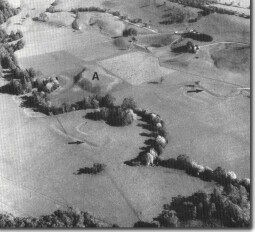
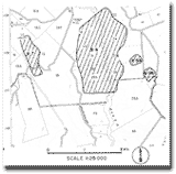
| Location: | 8-075280. Two kilometres south west of Carlisle River. | flood plain  Avulsion channel (arrowed) and isolated hill (A) on the flood plain of the Carlisle River. |
Access: | Off Gellibrand Road. | |
Ownership: | Private land. | |
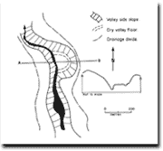
Geomorphology: | A narrow elongated drainage basin parallel to the Carlisle River has a wide, dry valley floor and steep valley side slopes. A higher level abandoned meander occurs near the outlet to the basin. The steepness of the valley sides indicate a period of rapid down cutting (including the isolation of the meander) followed by channel alluviation. | |
Significance: | Regional. The site illustrates the nature of valley development in the Tertiary formations on the north western flank of the Otways. As fluvial processes are now of little importance in this small catchment the site is useful to illustrate that discharge patterns and denudation rates have varied over the Quaternary period and that small drainage channels adjust to these changes. This catchment has been selected because a clear profile can be seen from the road crossing the valley. |


