
15.5 Colac Tree Road
|
This information has been developed from the publications:
|
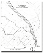
| Location: | 15-025125 top 15-005165 (along Colac Tree Road north from Wangerrip). | |
Access: | Colac Tree Road. | |
Ownership: | Crown land. | |
Geology/Geomorphology: | This site is suggested as a strip approximately 100 m wide to the east of Colac Tree Road. It is a traverse demonstrating a landform, soils and vegetation change due to a change in lithology from the Otway Group sediments on the axis of the Crowes Anticline (at Wangerrip) to the leached sands of the Dilwyn Formation five kilometres to the north. On the Otway Group sediments, the valley side slopes fall steeply to Skinner Creek but the terrain is more subdued on the sands of the Dilwyn Formation. | |
Significance: | Regional. The traverse illustrates a common landform sequence on the north-western flank of the Otway Ranges. | |
© State of Victoria (Agriculture Victoria) 1996 - .

This work, Victorian Resources Online, is licensed under a Creative Commons Attribution 4.0 licence. You are free to re-use the work under that licence, on the condition that you credit the State of Victoria (Agriculture Victoria) as author, indicate if changes were made and comply with the other licence terms.
The licence does not apply to ‘branding’ or some ‘images or photographs’ that may be owned by third parties. We ask you to seek prior approval to use images using the VRO feedback form. Access to higher quality images can also be provided on request.
This page was last updated on .