
8.10 A/B Carlisle River Tributaries - Reference Catchments
|
This information has been developed from the publications:
|
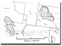
| Location: | 8-125223 (8A); 8-150230 (8B). | |
Access: | From Great Ocean Road at Pile Siding. | |
Ownership: | Crown land. | |
Geology/Geomorphology: | These two small catchments form part of the headwaters of the Carlisle River. They drain on the northern slope of the main ridge that divides the Gellibrand and Aire Rivers, the two largest drainage basins in the Otway Ranges. They originate in the highest rainfall area in Victoria, (Weeaproinah 1 928 mm, Beech Forest 1 731 mm) and support a relatively undisturbed forest association dominated by mountain ash, mountain grey gum and messmate. Beech forest occurs on the valley floors. The catchments comprise valuable reference sites to illustrate drainage basin development in a high rainfall region because they have been minimally disturbed by forest operations and land clearance. | |
Significance: | State. As the highest rainfall catchments in Victoria, these sites are important reference areas for the study of runoff generated in forested catchments. They could provide base data to allow accurate determination of potential water yield from the Otway region. | |
© State of Victoria (Agriculture Victoria) 1996 - .

This work, Victorian Resources Online, is licensed under a Creative Commons Attribution 4.0 licence. You are free to re-use the work under that licence, on the condition that you credit the State of Victoria (Agriculture Victoria) as author, indicate if changes were made and comply with the other licence terms.
The licence does not apply to ‘branding’ or some ‘images or photographs’ that may be owned by third parties. We ask you to seek prior approval to use images using the VRO feedback form. Access to higher quality images can also be provided on request.
This page was last updated on .