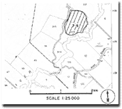
7.5 Carlisle River - Gellibrand River Backswamp
|
This information has been developed from the publications:
|
| Location: | 7-057215. Three kilometres west of Carlisle River and adjacent to the SRWSC pumping station. | |
Access: | SRWSC Private Road. | |
Ownership: | Private land. | |
Geomorphology: | An amphitheatre basin lies at the foot of the steep western valley slope of the Gellibrand River. The basin has a small enclosed catchment comprising seven small tributary streams, each of which heads in a small landslip. | |
Significance: | Local. The site illustrates an unusual process of valley slope development. | |


