
Kangaroo Hill (Denver)
|
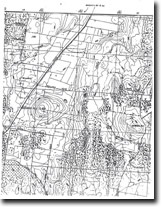
371630S 1441800E; 7723-2-4 (Coliban) 611716. 11 km SW of Malmsbury. | 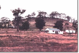 Kangaroo Hill | |
Daylesford-Malmsbury Road. | ||
Daylesford and Glenlyon. | ||
Private land. Grazing, few trees on top, outcrop at summit. | ||
| Type 4: | Lava hill. | |
The flat-topped lava mound has a summit bounded by basalt escarpments. Lava from this vent followed the ancestral Coliban River forming the Kangaroo Hill deep lead. The base of the flow is exposed at many localities along the present Coliban valley near Malmsbury and Taradale. | ||
658 m; 75 m. | ||
Regional: | An example of a very large deep lead flow eruption point. | |
Class 2: | Small farm development or closer subdivision will increasing isolate the eruption point. | |
| References: | Edwards, A. B. (1938). The Tertiary volcanic rocks of central Victoria. Quarterly Journal of the Geological Society of London 94, pp. 243-320. Coulson, A. (1954). The volcanic rocks of the Dayles ford district. Proceedings of the Royal Society of Victoria 65, pp. 113-124. | |
© State of Victoria (Agriculture Victoria) 1996 - .

This work, Victorian Resources Online, is licensed under a Creative Commons Attribution 4.0 licence. You are free to re-use the work under that licence, on the condition that you credit the State of Victoria (Agriculture Victoria) as author, indicate if changes were made and comply with the other licence terms.
The licence does not apply to ‘branding’ or some ‘images or photographs’ that may be owned by third parties. We ask you to seek prior approval to use images using the VRO feedback form. Access to higher quality images can also be provided on request.
This page was last updated on .