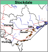
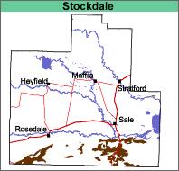
Stockdale (Sd)
|
Geology |  |  |
Mixed forest, mainly comprising stringybark and box.
Previous Maps and Reports
This map unit is meant to be identical to that described by Poutsma and Turvey (1979) who mapped a small area on this mapsheet south of the La Trobe River. The Stockdale Land System as described by Aldrick et al. (1992) contains a broader range of soils.
Soils
The soils are all texture contrast soils, with a dark brownish grey loamy sand or sand surface soil overlying a conspicuously bleached (typically light yellowish brown) similarly textured subsurface horizon at about 20 cm. Yellowish brown, usually mottled with red brown and grey, medium clays to sandy clays occur abruptly at between 35 and 70 cm. Sandier textures may occur in the deep subsoil.
Although these soils are all texture contrast in nature - it appears from observations of similar soils in adjacent areas, that there is probably a reasonable degree of variability in the chemical properties of the upper subsoil. Therefore, these soils are most likely to be classified as either Brown and Grey Sodosols, Chromosols or Kurosols (with sandy surface horizons) using the Australian Soil Classification.
Chemical and Physical Analysis
No physical or chemical analyses have been carried out on the soils of this map unit.
Land Use
The land is mostly used for forestry, both hardwood and pine.
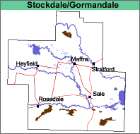
Stockdale with Gormandale (Sd/Go)
This map unit comprises mainly Stockdale with less than 30% of the Gormandale map unit.
Geology Pliocene alluvial sediments with Pliocene and Pleistocene aeolian sediments. Landform Undulating plain with dunefields. Original Vegetation See Stockdale and Gormandale map units. |  |
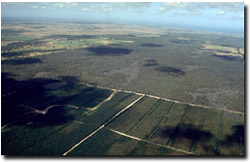
| Previous Maps and Reports Poutsma and Turvey (1979) mapped small areas of these types south of the La Trobe River. Soils See Stockdale and Gormandale map units. Land Use The land is mostly used for forestry, both hardwood and pine. |  Looking east towards the coast over the Mullundung State Forest. Pine trees in the foreground are planted on the Stockdale and Gormandale mapping units. |
Stockdale, grey profile (Sd,gp)
This map unit is similar to Stockdale, except that the surface soil tends to be greyer and shallower.
Stockdale with Gormandale, gravely (Sd/Go,gv)
This map unit is similar to that described under Stockdale with Gormandale except that, with particularly the more sandy soils, variable amounts of coarse gravel and small quartz stones occur throughout the soil profile.


