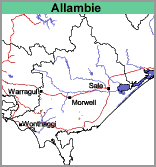
Allambie (Ab)
|
Geology |  |
Mostly grazing, but where areas of this soil occurs within the Warragul mapping unit vegetable cropping may also occur.
Soils
Variable, including gritty versions of Warragul and Silver Creek to gravel deposits of that epoch.
Allambie with Warragul (Ab/Wg)
This mapping unit describes areas, comprising mostly the Allambie mapping unit with some areas of the Warragul mapping unit. The percentage of the dominant mapping unit is at least 70%.


