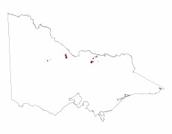
4.4 Hills and low hills (Terrick Terrick Range, Mt. Major, Mt. Wycheproof)
4. Northern Riverine Plain (RP)
| Within the Northern Riverine Plains (RP) there are a number of hills, low hills and rises that occur at various distances away from the main body of the Eastern (EU) and Western (WU) Uplands. These features are either relatively close to the uplands in the east or further away and more isolated in the west. The hills and associated features such as rises and apron/fan material tend to be low in the landscape in the east of the plains, apart from the Dookie hills complex (approximately 100 km2 in area) which have a relative relief of up to 220 m and highest point of Mt Major (379 m). Slopes are about 20-45 % with gentler gradients on lower slopes and associated fans Other isolated rises and low hills often have shallow slopes though some of the outlying hills of the eastern Uplands can be steep (Creighton Hill). The hills and associated features further to the west and further away from the main uplands are prominent with rounded and rocky terrain. These occurrences are dominated by the Terrick Terrick Range north of Mitiamo, about 120 km2 in area, with a relative relief of up to100 m (Mt Terrick terrick, 196 m) and slopes. Isolated low hills such as Pyramid Hill (192 m), Mount Hope (202 m) and Mt Wycheproof are distinctive in form and imply resistance to erosion. |  |
Mt. Wycheproof (143 m) is a small rocky conical peak, a resistant granitic outcrop with fan material with Wycheproof township on its south western lower slopes; a resistant granitic outcrop with fan material.
The eastern hills are either a folded(/faulted) sequence of Palaeozoic rocks, associated Cambrian greenstones and cherts being exposed as the Dookie hills or isolated granitic outcrops occurring further north. The greenstone/chert sequence is also seen as an outlier of the Western Uplands (Colbinabbin Range). The Palaeozoic outcrops are sub parallel with the Eastern Uplands or associated with outlying ridges. There are also minor occurrences of Permian tillite and Palaeogene basalt rises.
The hills further west are all granitic with a number of isolated outcrops away from the main range and generally more prominent than the deeply weathered Palaeozoic landforms of the Western Uplands grading into the Northern Riverine Plains.
Drainage tends to be radial or sub parallel with limited expression given the size of the landforms and the nature of the parent material (degree of structural control).
In the eastern area, the regolith is shallow on the steeper slopes (often less than 1 m) but much deeper on lower slopes and associated fan material where soils are deeper with greater development. Soils with greater agricultural potential exist around the Dookie Hills due to the higher base status, particularly calcium derived from the greenstones. Soil types would include Calcarosols (calcareous gradational soils), often red and Vertosols (cracking and self-mulching), generally black. Generally these regolith material are quite stable, depending on terrain (ie. slope). Depth of soil and regolith may vary on the Palaeozoic sedimentary terrain with texture contrast soils often sodic and either red or mottled.
The drier western area has stony shallow regolith and soils on the crests and upper slopes with a high coarse sand fraction. Sandy surfaces are characteristic downslope as well but with clay at variable depth. Regolith would be shallow on most of the isolated outcrops but deeper on fan material. Soils range from Rudosols (shallow and stony), Tenosols (some soil development, moderate - deep) to Sodosols (sodic texture contrast). These regolith materials are more prone to land degradation with looser, coarser top soils and generally little basic nutrient content apart from an accumulation of clay or weathering front.
These hills are an important source of stone and gravel, and the Terrick Terrick Range has a consistently treed area.
Related information on VRO
- A Study of the Land in North-western Victoria (J N Rowan and R G Downes 1963)
- Land Inventory of the Loddon River Catchment - a reconnaissance survey (N Schoknecht 1988)
- A Study of the Land in the Catchment of the Avoca River (M. S. Lorimer and J. N. Rowan 1982)


