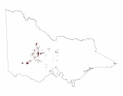
2.1.7 Terraces and floodplains (Upper Loddon, Upper Woady Yallock Creek, Pomonal - Moyston area, Crowlands, Avoca, Newstead)
2. Western Uplands (WU)
2.1 Dissected Uplands
| Alluvial flats are a common feature in most valley floors. In some valleys, the majority of the alluvium has been deposited in episodes of drainage disruption and blockages during the Late Neogene volcanism. Examples include the extensive alluvial flats of the Lal Lal Swamp and Dog Trap Creek. Some minor sandy deposits are associated with the Lal lal swamp (lunette). Soil types present include dark self-mulching clays, texture contrast soils, some gradational soils and minor sandy soils. Alluvial systems within the Dissected Uplands of the Wimmera CMA region include Mount Cole Creek, Mount William Creek and the Wimmera River. Mount Cole Creek, the upper Wimmera River and other minor tributaries are supplied surface and groundwaters by Palaeozoic bedrock hilly terrain and Neogene cappings that line many lower hillslopes. As a tributary that supplies the Wimmera River, Mount William Creek rises on the slopes of Mt. William in the Grampians and flows slowly to the north-west through Dadswells Bridge. Extensive alluvial plains of this drainage system represent a low pass (geocol) that separates the Dissected Uplands (Midlands) to the east from the Grampians to the west. |  |
These fluviatile alluvia plains are characterised by its effluents and anabranches which leave the main channels (Sibley 1967). The tributaries are called subsequent streams where streams have evolved along areas of rock belt weakness leaving folded or titled strata of differing resistance as prominent strike ridges (Hills 1975). Drainage networks of Mount William Creek, Salt Creek, upper Wimmera River/Mount Cole Creek and Wattle Creek are aligned in a north north-westerly alignment with strike ridges on a regular spacing of 10-15 kilometres. Valley flats, terraces and flood out plains are common with Mount William Creek broadest in cross tributary dimension (often in excess of 5 kilometres) while others are typically less than 2 kilometres. Slopes are gentle to very gently inclined with terrace slopes of greatest inclination (up to 10%) found along Mount Cole Creek and upper Wimmera River.
The entrenched valleys of Quaternary sediments including the Shepparton Formation (a thick sequence of unconsolidated fluvial and lacustrine sediments – coarse sand, silt and clay) occur largely as terraces, plains and drainage lines. Sediments have been derived through differential weathering of granite masses that are surrounded by ridges and peaks of resistant metamorphosed sediments. The Coonambidgal Formation (reworked Shepparton Formation of slightly micaceous silty clay, sand and gravel) occur within drainage lines subject to flooding and inset streams (Butler 1958, Krokowski de Vickerod, Moore & Cayle 1997).
Flood plains of Mount William Creek are lined by aeolian deposits (sands) sourced from the Grampians and lined by River Red gums on subdued slopes of this inset stream. The plains and terraces of the upper reaches of the Wimmera River system around Mount Cole Creek, Concongella and Elmhurst have been formed by the more rapid weathering of granitic rocks in the area, accompanied by the deposition of recent alluvial sediments. Incipient weathering profiles of older fluvial deposits have some mottling reflecting poor site drainage and clay alleviation processes. Granitic detritus of these valley systems has high concentrations of quartzose sand intermixed with silts that often compose terraces occupying elevated positions above the current drainage plain.
Soils of the unit are deep grading into the generally unconsolidated regolith. These may range from texture contrast, generally sodic (Sodosols) to gradational earths and occasional clay (Vertosols, Dermosols) and sandy soils (Tenosols). Some soils may be waterlogged prone for at least 3 months of the year (Hydrosols).
The texture contrast soils vary between the red non-sodic soils against the brown, yellow and grey sodic variants. All have sandy loam surfaces overlying a massive conspicuously bleached subsurface horizon. A clear change exists to light and medium clay subsoils where sodicity and colour are the distinguishing features. Importantly, the red texture contrast soils are commonly associated with terraces rather than current alluvial plains. Here most of the gradational yellow and brown soils (Kandosols) are found.
Remnant vegetation communities are dominated by forests (Heathy Dry Forest and Grassy Forest) closest to intersection of the Wimmera River downstream of Greens Creek where stream gradients are low and anabranching is well defined. Woodlands including Damp Sands Herb-rich Woodland, Plains Grassy Woodland, Creekline Grassy Woodland, Riparian Woodland, Plains Woodland, Grassy Woodland occur along Mount William Creek with Lateritic Woodland, Sand Heathland, Sand Forest, Red Gum Wetland and Sedge Wetland found on floodplains and flats away from the current drainage depression.
Heathy Dry Forest and Grassy Forest vegetation communities are associated with exposed areas of the alluvial plains of the Upper Wimmera River and Mount Cole Creek while Herb-rich Foothill Forest and Valley Grassy Forest are more associated with sheltered areas higher in the catchment. Various woodlands including Alluvial Terraces Herb-rich Woodland also occur across these valleys. Dry woodlands dominate drainage of Six Mile Creek/Seven Mile Creek and Salt Creek.
The alluvial plains often compose later derived sediments that overlie gravels and sands of these valley deposits. Large volumes of groundwater are attributed to these alluvial systems through contributions of Grampians colluvium where rainfall is often twice that of the plains. Wetlands line Mount William Creek especially north of Jallukar to its integration with the Wimmera River. Lake Lonsdale and Lake Fyans represent large swamps that have now been dammed to form water supply dams for Stawell and Ararat.
Further east, Greens Swamp (includes a main swamp and shallow ephemeral wetland) has been derived from a small catchment that has been unable to breach the levee of the Wimmera River (Hocking 2004). This swamp has a large clay lunette that pre dates major lake forming processes of the Murray Basin and reflects an intricate balance between climatic and groundwater conditions for lunette development.


