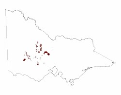
2.1.4 Hills, valley slopes and plains on plutonic Palaeozoic rocks (Pittong, Harcourt, Amphitheathre, Victoria Valley)
2. Western Uplands (WU)
2.1 Dissected Uplands
| The granite plutons away from the steep and topographically prominent landforms (Langi Ghiran, western Black Range) are generally subdued hills, low hills and plains with deeply weathered bedrock such as those at Rocky Point and footslopes surrounding prominent mountains and escarpments. These subdued plutons (often referred to as negative relief) such as the Ararat Granodiorite (Rocky Point at over 550 m) forms topographically lower relief landscapes when compared to the higher relief metamorphic aureoles (e.g. Mount Ararat – 618 m) that surround the pluton. Erosion has seen the unroofing of these plutons from Late Palaeozoic time to leave exposures we see today. Slopes are typically moderately to gently inclined with variable weathering producing tors and boulders through to thick kaolin clays. Tributaries are prevalent where saprolite is deepest and ultimately contributed surface and groundwaters into the Wimmera River, Mount Cole Creek and Mount William Creek systems. The subdued granites are more susceptible to weathering owing their accelerated erosion to higher biotite concentrations and lesser plagioclase than more prominent granitic landscapes (Hill 1992, 1996). Large concentrations of transported residual sand blanket much of the underlying bedrock while in places the regolith is characterised by deep kaolin deposits that is often overlain by later Cainozoic sediments. |  |
Soil profiles with sandy surfaces and strongly texture contrast are common on these granite landscapes. Sodic yellow texture contrast soils (Sodosols) are strongly acidic at surface, becoming slightly acidic or neutral at depth. Conspicuously bleached subsurface horizons overlie medium to heavy clays that act as a hydraulic throttle to water movement through the soil profile. Lighter weathered material often occurs under these clays. Soils are generally deeper than those of Langi Ghiran and western Black Range.
Vegetation communities include Grassy Dry Forest, Granitic Hills Woodland, Grassy Woodland, Herb-rich Woodland, and Granitic Hills Woodland on more exposed slopes where Alluvial Terraces and Herb-rich Woodland occupy lower slopes and drainage depressions.
Saline discharge occurs at break of slope as perched groundwater moves laterally down slope through colluvium of footslopes and foothills. Occasionally this groundwater contributes to underlying basal aquifers in valleys.
Granitic slopes are prone to sheet and rill erosion from extreme rainfall events. Landslides and mud flows can eventuate where significant rainfall is combined with land clearance and steep slopes causing soils to fail (e.g. Rocky Point).


