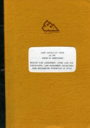
Land Capability Study in the Shire of Shepparton
The study was prepared in June 1981 by J F Wood, District Soil Conservationist; P R Burns, Conservation Assistant and D F Howe, Senior Reserach Officer of the former Soil Conservation Authority, at the request of the former Shire of Shepparton for use as an aid to planning and development at a broad scale. The report describes erosion risk and other characteristics of the land which may impose constraints on land development in the Shire. The former Shepparton Shire had a area of approximately 915 km2, varying from flat plains at about 105 m elevation receiving about 375 mm rainfall in the north, to low hill country up to 279 m elevation on Mt. Major where average annual rainfall was 560 mm. Approximately 95% of the Shire was freehold land (870 km2) the reminder being largely forested public land. The study concentrates on the freehold land and is less detailed on the public land. Areas of special interest to the former Soil Conservation Authority are the Cashel Bank and Dookie-Cosgrove Cooperative projects.
 | Land capability study in the Shire of Shepparton (PDF - 592 KB) Land capability study in the Shire of Shepparton (363 KB) To view the information PDF requires the use of a PDF reader. This can be installed for free from the Adobe website (external link). |
Related Links on VRO

