
WLRA131
|
| WLRA131 | 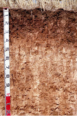 Sodic, Hypercalcic, Red CHROMOSOL | |
|
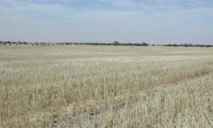
Location | Jeparit Road Peppers Plains, Warracknabeal, Western Victoria | |||
|
Landform | Undulating plain | |||
|
Geology | Quaternary Woorinen Formation: aeolian dune sand, calcareous clay | |||
|
Element | Mid slope | |||
|
Slope | 1% | |||
|
Aspect | South-west | |||
Horizon | Depth (cm) | Description | ||
A11 | 0–5 | Dark brown (10YR3/3); sandy loam; moderate medium to very fine polyhedral structure; rough ped fabric; weak consistence dry; pH 7.7; smooth and abrupt change to: | ||
A12 | 5–15 | Dark brown (7.5YR3/2); loam; massive (structureless); earthy ped fabric; firm consistence, dry; weakly cemented cultivation pan evident; pH 7.5; abrupt and wavy change to: | ||
B21 | 15–35 | Yellowish red (5YR4/5); light medium clay; strong coarse prismatic, parting to medium angular blocky structure; smooth ped fabric; strong consistence dry; contains very few fine manganiferous nodules; pH 8.5; gradual and smooth change to: | ||
B22k | 35–75 | Reddish yellow (7.5YR6/6) with a few faint fine red mottles; light clay; weak coarse polyhedral structure; rough ped fabric; firm consistence, moderately moist; contains very many extremely coarse calcareous soft segregations, very few medium calcareous nodules and argillaceous tubules; pH 9.1; diffuse and smooth change to: | ||
B23k | 75–135 | Reddish yellow (7.5YR7/6); light clay; weak medium to coarse polyhedral structure; rough ped fabric; weak consistence moderately moist; contains many extremely coarse calcareous soft segregations and a few fine manganiferous fragments; pH 9.9. | ||
| Management Considerations | ||||
| ||||
Horizon | Depth (cm) | pH (water) | pH (CaCl2) | EC dS/m | Exchangeable Cations cmol-/kg | |||
Ca | Mg | K | Na | |||||
A11 | 0-5 | 7.7 | 7.3 | 0.19 | 13 | 3.8 | 2 | 0.29 |
A12 | 5-15 | 7.5 | 7.1 | 0.12 | 13 | 4.2 | 1.6 | 0.45 |
B21 | 15-35 | 8.5 | 8 | 0.18 | 15 | 7.7 | 1.6 | 0.98 |
B22k | 35-75 | 9.1 | 8.5 | 0.51 | 8.5 | 12 | 2 | 3.6 |
B23k | 75-135 | 9.9 | 9.4 | 0.66 | 2.6 | 11 | 2.2 | 7.1 |
© State of Victoria (Agriculture Victoria) 1996 - .

This work, Victorian Resources Online, is licensed under a Creative Commons Attribution 4.0 licence. You are free to re-use the work under that licence, on the condition that you credit the State of Victoria (Agriculture Victoria) as author, indicate if changes were made and comply with the other licence terms.
The licence does not apply to ‘branding’ or some ‘images or photographs’ that may be owned by third parties. We ask you to seek prior approval to use images using the VRO feedback form. Access to higher quality images can also be provided on request.
This page was last updated on .