
WLRA66
|
| WLRA66 | ||
|
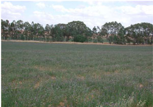
Location | Joel, western Victoria | |||
|
Landform | Alluvial plain | |||
|
Geology | Quaternary Coonambidgal Formation: fluvial to lacustrine clays and sands | |||
|
Element | Terrace | |||
|
Slope | West | |||
|
Aspect | ||||
Horizon | Depth (cm) | Description | ||
A1 | 0–8 | Dark brown to brown (7.5YR4/3); loamy sand; weak fine subangular blocky structure; rough ped-fabric; very weak consistence when dry; pH 6.0; abrupt boundary to: | ||
A21 | 8–35 | Light brown (7.5YR6/4); conspicuously bleached (7.5YR7/4 dry); loamy sand; single grain , occasionally massive (structureless); earthy ped-fabric; very weak consistence when dry; pH 6.5; gradual boundary to: | ||
A22 | 35–65 | Very pale brown (10YR7/4); conspicuously bleached (10YR8/3 dry); loamy sand, silty; single grain, occasionally massive (structureless); earthy ped-fabric; weak consistence when dry; pH 7.2; sharp boundary to: | ||
B21 | 65–110 | Light yellowish brown(10YR6/4) with many coarse (7.5YR5/4) mottles; sandy loam, heavy; massive (structureless); earthy ped-fabric; very firm consistence when slightly moist; pH 8.5; gradual boundary to: | ||
B22 | 110–120+ | Light yellowish brown (10YR6/4) with common medium faint (10YR5/4) mottles; loam, fine sandy; massive (structureless); earthy ped-fabric; very firm consistence when slightly moist; pH 9.0 | ||
| Management considerations | ||||
| ||||
© State of Victoria (Agriculture Victoria) 1996 - .

This work, Victorian Resources Online, is licensed under a Creative Commons Attribution 4.0 licence. You are free to re-use the work under that licence, on the condition that you credit the State of Victoria (Agriculture Victoria) as author, indicate if changes were made and comply with the other licence terms.
The licence does not apply to ‘branding’ or some ‘images or photographs’ that may be owned by third parties. We ask you to seek prior approval to use images using the VRO feedback form. Access to higher quality images can also be provided on request.
This page was last updated on .