
WLRA55
|
| WLRA55 | ||
|
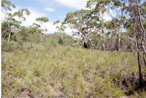
Location | Mount Stapylton, western Victoria | |||
|
Landform | Low hill | |||
|
Geology | Grampians colluvium | |||
|
Element | Hillslope | |||
|
Slope | 35% | |||
|
Aspect | West south west | |||
Horizon | Depth (cm) | Description | ||
A1 | 0–5 | Brown (10YR5/3); loamy sand; weak medium polyhedral structure; rough ped-fabric; weak consistence (dry); water repellent; pH 5.5; abrupt boundary to: | ||
A2 | 5–20 | Yellowish brown (10YR5/4); conspicuously bleached light grey (10YR7/2 dry); loamy sand; massive (structureless); weak consistence when dry; coarse ferruginous nodules are common ; pH 6.0; gradual boundary to: | ||
B1 | 20–60 | Light grey (10YR6/2) with many coarse distinct (10YR6/6) mottles; silty clay loam, heavy; moderate polyhedral structure; smooth-ped fabric; strong consistence when moderately moist; few coarse ferruginous nodules; pH 5.5; gradual boundary to: | ||
B21 | 60–90 | Light grey (2.5Y7/2) with many coarse prominent (2.5YR4/6) mottles; light medium clay; weak polyhedral structure; smooth-ped fabric; very firm consistence when moderately moist; pH 5.0; clear boundary to: | ||
B22 | 90–115 | Reddish brown (5YR5/4) with coarse distinct light brownish grey mottles common; light clay; massive (structureless); very firm consistence when dry; pH 4.5; clear boundary to: | ||
B3 | 115–130+ | Light grey (2.5Y7/2) with many prominent coarse dark olive brown mottles; sandy loam, very few small subangular quartz fragments; massive (structureless); very firm consistence when moderately moist; pH 4.0. | ||
| Management considerations | ||||
| ||||
© State of Victoria (Agriculture Victoria) 1996 - .

This work, Victorian Resources Online, is licensed under a Creative Commons Attribution 4.0 licence. You are free to re-use the work under that licence, on the condition that you credit the State of Victoria (Agriculture Victoria) as author, indicate if changes were made and comply with the other licence terms.
The licence does not apply to ‘branding’ or some ‘images or photographs’ that may be owned by third parties. We ask you to seek prior approval to use images using the VRO feedback form. Access to higher quality images can also be provided on request.
This page was last updated on .