
GL164
|
| GL164 | 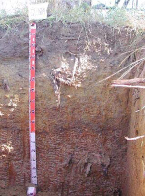 Fertic (& Reticulate), Petroferric, Brown Chromosol | |
|
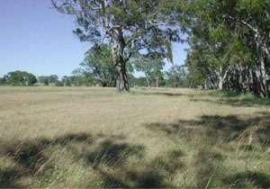
Location | Balmoral, western Victoria. | |||
|
Landform | Undulating plain | |||
|
Geology | Pliocene Parilla Sand: marine sand and silt | |||
|
Element | Flat | |||
|
Aspect | 0–1% | |||
Horizon | Depth (cm) | Description | ||
A1 | 0–25 | Very dark grey (7.5YR3/1); sandy loam; weak blocky structure (10-50 mm); weak consistence when dry; very few medium angular ferruginised nodules (6-20 mm); pH 6.5; clear and wavy boundary to: | ||
A2 | 25–40 | Dark yellowish brown (10YR4/4); fine sandy clay loam; massive (structureless) to weak blocky structure (10-50 mm); firm consistence when moist; many medium to coarse ferruginous and manganiferous nodules; pH4.7; clear and wavy boundary to: | ||
B2 | 40–60 | Dark yellowish brown (10YR4/6); light medium clay, sandy; weak fine blocky structure; firm consistence when moist; many coarse ferruginous and manganiferous nodules; pH 5.5; clear but wavy boundary to: | ||
BC | 60–85 | Mainly buckshot; ferruginous and manganiferous nodules are abundant; moderately cemented discontinuous; ferricrete pan; abrupt but wavy boundary to: | ||
C | 85–150 | |||
| Management considerations | ||||
| ||||
Site GL164 | Sample depth cm | pH | EC dS/m | NaCl % | Ex Ca cmol-/kg | Ex Mg cmol-/kg | Ex K cmol-/kg | Ex Na cmol-/kg | EX Al mg/kg | Ex acidity cmol-/kg | FC -30okPa | PWP -1500okPa | KS % | FS % | Z % | C % | |
Horizon | H2O | CaCl2 | |||||||||||||||
A1 | 0–25 | 6.5 | 6.0 | 0.11 | NA | 8.1 | 2.2 | 0.42 | 0.38 | NA | NA | NA | NA | 13.6 | 54.4 | 8.5 | 16.5 |
A2 | 25–40 | 4.7 | 4.0 | 0.08 | NA | 0.54 | 1.7 | 0.12 | 0.4 | 220 | NA | NA | NA | 12.8 | 46.6 | 8 | 29.5 |
B2 | 40–60 | 5.5 | 4.6 | 0.08 | NA | 1.4 | 4 | 0.16 | 0.68 | 53 | NA | NA | NA | 9.6 | 35.3 | 8 | 46.5 |
Note: NA=not assessed
© State of Victoria (Agriculture Victoria) 1996 - .

This work, Victorian Resources Online, is licensed under a Creative Commons Attribution 4.0 licence. You are free to re-use the work under that licence, on the condition that you credit the State of Victoria (Agriculture Victoria) as author, indicate if changes were made and comply with the other licence terms.
The licence does not apply to ‘branding’ or some ‘images or photographs’ that may be owned by third parties. We ask you to seek prior approval to use images using the VRO feedback form. Access to higher quality images can also be provided on request.
This page was last updated on .