
LSWW8
|
| LSWW8 |  Hypercalcic, Mottled-Hypernatric, Yellow Sodosol (medium sandy surface) | |
|
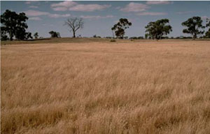
Location | Lillimur South (near the Little Desert National Park), western Victoria | |||
|
Landform | Dune | |||
|
Geology | Quaternary Lowan Formation: aeolian fine to medium grained dune sand | |||
|
Element | Duneslope | |||
Horizon | Depth (cm) | Description | ||
1A1 | 0–10 | Very dark greyish brown (10YR3/2) loamy sand; single grain (structureless); loose consistence when dry; pH 5.5; abrupt boundary to: | ||
1A2 | 10–25 | Pink (7.5YR7/4); conspicuously bleached (7.5YR8/2); sand; single grain (structureless); loose consistence when dry; very few ferruginous nodules; pH 6.6; below this horizon there is a 2 mm capping on top of the clay columns; sharp boundary to: | ||
1B21 | 25–40 | Light yellowish brown (10YR6/4) with abundant coarse faint brownish yellow mottles; medium heavy clay; strong very coarse columnar structure, some areas under columns have strong medium prismatic, parting to moderate medium blocky structure; very strong consistence when dry (complete dispersion); pH 8.1; gradual and wavy boundary to: | ||
1B22 | 40–70 | Light yellowish brown (10YR6/4) medium heavy clay; moderate medium prismatic, parting to moderate medium blocky structure; complete dispersion; pH 9.0. | ||
BC | 70–110 | White (2.5Y8/2) with abundant very coarse prominent red and distinct yellow mottles; light sandy loam; , massive (structureless); very weak consistence when dry; pH 9.6; weathered sandstone with an older surface underneath. | ||
2B2 | 110–200+ | Light grey (2.5Y7/2) with abundant very coarse prominent red and brownish yellow mottles although decreasing with depth; medium heavy clay; strong coarse, parting to strong fine lenticular structure; smooth ped-fabric; few slickensides; pH 9.2. | ||
| Management considerations | ||||
| ||||
Site WW8 | Sample depth cm | pH | EC dS/m | NaCl % | Ex Ca cmol-/kg | Ex Mg cmol-/kg | Ex K cmol-/kg | Ex Na cmol-/kg | Ex Al mg/kg | Ex acidity cmol-/kg | FC -30okPa | PWP -1500okPa | KS % | FS % | Z % | C % | |
Horizon | H2O | CaCl2 | |||||||||||||||
1A1 | 0–10 | 5.5 | 4.7 | 0.11 | NA | 1.4 | 0.3 | 0.2 | 0.2 | NA | NA | NA | 6.3 | 36.6 | 48.6 | 3.5 | 5 |
1A2 | 10–25 | 6.6 | 5.6 | <0.05 | NA | <0.1 | <0.1 | <0.1 | 0.1 | NA | NA | NA | NA | NA | NA | NA | NA |
1B21 | 25–40 | 8.1 | 6.7 | 0.1 | NA | 2.8 | 4.4 | 0.8 | 3 | NA | NA | NA | 13.8 | 26.3 | 32.5 | 3 | 35 |
1B22 | 40–70 | 9 | 7.7 | 0.18 | NA | 3.6 | 6.3 | 1.3 | 4.6 | NA | NA | NA | NA | NA | NA | NA | NA |
BC | 70–110 | 9.6 | 8.6 | 0.47 | 0.05 | NA | NA | NA | NA | NA | NA | NA | 11.6 | 21.4 | 44 | 0.5 | 27.5 |
2B2 | 110–200+ | 9.2 | 8.5 | 0.62 | 0.09 | 2.9 | 10 | 1 | 9.2 | NA | NA | NA | NA | NA | NA | NA | NA |
© State of Victoria (Agriculture Victoria) 1996 - .

This work, Victorian Resources Online, is licensed under a Creative Commons Attribution 4.0 licence. You are free to re-use the work under that licence, on the condition that you credit the State of Victoria (Agriculture Victoria) as author, indicate if changes were made and comply with the other licence terms.
The licence does not apply to ‘branding’ or some ‘images or photographs’ that may be owned by third parties. We ask you to seek prior approval to use images using the VRO feedback form. Access to higher quality images can also be provided on request.
This page was last updated on .