
LSWW28
|
| LSWW28 | 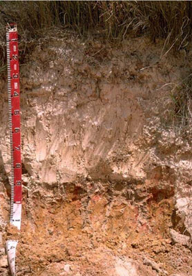 Yellow Sodosol | |
|
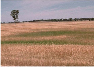
Location | Telopea Downs, western Victoria | |||
|
Landform | Dune | |||
|
Geology | Quaternary Lowan Formation: aeolian fine to medium grained dune sand | |||
|
Element | Duneslope | |||
Horizon | Depth (cm) | Description | ||
A11 | 0–15 | Grey (10YR5/1); sand; single grain (structureless); pH 6.6. | ||
A12 | 15–35 | Light brownish grey (10YR6/2); sand; single grain (structureless); pH 7.2. | ||
A13 | 35–80 | Light yellowish brown (10YR6/4); sand; single grain (structureless); pH 8.2. | ||
B2 | 80–90 | Light yellowish brown (10YR6/4) with reddish yellow and red mottles; sandy clay; clay tends to occur as clay skins in pockets such as root channels; pH 8.1. | ||
C | 90–120+ | Weathered sandstone. | ||
| Management considerations | ||||
| ||||
Site WW28 | Sample depth cm | pH | EC dS/m | NaCl % | Ex Ca cmol-/kg | Ex Mg cmol-/kg | Ex K cmol-/kg | Ex Na cmol-/kg | Ex Al mg/kg | Ex acidity cmol-/kg | FC -30okPa | PWP -1500okPa | KS % | FS % | Z % | C % | |
Horizon | H2O | CaCl2 | |||||||||||||||
A11 | 0–15 | 6.6 | 5.9 | <0.05 | NA | NA | NA | NA | NA | NA | NA | NA | NA | NA | NA | NA | NA |
A12 | 15–35 | 7.2 | 6.4 | <0.05 | NA | NA | NA | NA | NA | NA | NA | NA | NA | NA | NA | NA | NA |
A13 | 35–80 | 8.2 | 7.3 | <0.05 | NA | NA | NA | NA | NA | NA | NA | NA | NA | NA | NA | NA | NA |
B2 | 80–90 | 8.1 | 7.1 | 0.12 | NA | NA | NA | NA | NA | NA | NA | NA | NA | NA | NA | NA | NA |
C | 90–120+ | NA | NA | NA | NA | NA | NA | NA | NA | NA | NA | NA | NA | NA | NA | NA | NA |
© State of Victoria (Agriculture Victoria) 1996 - .

This work, Victorian Resources Online, is licensed under a Creative Commons Attribution 4.0 licence. You are free to re-use the work under that licence, on the condition that you credit the State of Victoria (Agriculture Victoria) as author, indicate if changes were made and comply with the other licence terms.
The licence does not apply to ‘branding’ or some ‘images or photographs’ that may be owned by third parties. We ask you to seek prior approval to use images using the VRO feedback form. Access to higher quality images can also be provided on request.
This page was last updated on .