
Site IS18
Location: Drung Drung
Australian Soil Classification: Hypocalcic, Subnatric, Brown SODOSOL
General Landscape Description: Anastomotic plain.
Geology: Quaternary Shepparton Formation: fluvial silt, sand and minor gravel.
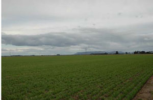 IS18 Landscape |
Soil Profile Morphology:
Surface Soil
| A1 | 0-10 cm | Dark brown (10YR4/3); sandy clay loam; hardsetting surface condition; weak coarse granular structure; very strong consistence dry; pH 7.4; sharp and smooth boundary to: | |
| Subsoil | |||
| B211 | 10-40 cm | Brown (7.5YR4/4); light clay; subplastic; moderate coarse prismatic structure; very strong consistence dry; sticky consistence wet; pH 8.4. | |
| B212 | 40-60 cm | Brown (7.5YR4/4); heavy clay; subplastic; moderate coarse prismatic structure; very strong consistence dry; sticky consistence wet; pH 9.4; clear and smooth boundary to: | |
| B22 | 60-90 cm | Pale brown (10YR6/3) with yellowish red (5YR5/8) mottles; medium clay; plastic; weak coarse subangular blocky structure; very strong consistence dry; sticky consistence wet; very few (<2%) hard carbonate segregations; pH 9.1; gradual boundary to: | |
| B23 | 90-120 cm | Light brownish grey (10YR6/2); heavy clay; plastic; weak coarse subangular blocky structure; very strong consistence dry; sticky consistence wet; very few (<2%) hard carbonate segregations; pH 9.1. | |
Soil Profile Characteristics:
Horizon | Sample Depth cm | pH | EC dS/m | Sodium Chloride % | Exchangeable Calcium cmol-/kg | Exchangeable Magnesium cmol-/kg | Exchangeable Potassium cmol-/kg | Exchangeable Sodium cmol-/kg | Exchangeable Aluminium mg/kg | Exchangeable Acidity cmol-/kg | Field Capacity -30okPa | Permanent Wilting Point -1500okPa | Coarse Sand % | Fine Sand % | Silt % | Clay % | |
H2O | CaCl2 | ||||||||||||||||
A1 | 0–10 | 7.4 | NA | 0.07 | 0.01 | 9 | 1.3 | 1.4 | 0.1 | NA | 3.7 | NA | 9.7 | 14 | 46 | 12 | 27 |
B211 | 10–40 | 8.4 | NA | 0.64 | 0.03 | 13.9 | 17.5 | 1.9 | 5.7 | NA | 3.9 | NA | 30 | 3 | 14 | 7 | 72 |
B212 | 40–60 | 9.4 | NA | 0.59 | 0.05 | 6.8 | 15.4 | 1.7 | 6.3 | NA | NA | NA | 23.1 | 5 | 26 | 11 | 53 |
B22 | 60–90 | 9.1 | NA | 0.86 | 0.12 | 5.5 | 14.4 | 1.5 | 6.9 | NA | NA | NA | 21.8 | 5 | 34 | 11 | 47 |
B23 | 90–120 | 9.1 | NA | 0.94 | 0.12 | 5 | 12.6 | 1.4 | 7.2 | NA | NA | NA | 20.5 | 7 | 35 | 12 | 43 |
B24 | 120–150 | 9.1 | NA | 1.01 | 0.15 | NA | NA | NA | NA | NA | NA | NA | 21.2 | 5 | 31 | 12 | 48 |
B25 | 150–185 | 9.2 | NA | 1.02 | 0.14 | NA | NA | NA | NA | NA | NA | NA | 19.5 | 5 | 32 | 11 | 43 |
B26 | 185–215 | 9.2 | NA | 0.95 | 0.15 | NA | NA | NA | NA | NA | NA | NA | 19.9 | 3 | 38 | 9 | 42 |
B27 | 215–245 | 8.9 | NA | 0.77 | 0.14 | NA | NA | NA | NA | NA | NA | NA | 17.2 | 1 | 46 | 10 | 42 |
B28 | 245–275 | 8.7 | NA | 0.69 | 0.13 | NA | NA | NA | NA | NA | NA | NA | 17.3 | 2 | 46 | 11 | 41 |
Management Considerations:
- Very strong texture contrast (27% to 72% clay), clay decreasing with depth.
- Alkaline soil, slightly decreasing at depth, high level of nutrients in upper subsoil (B22 horizon).
- Thin surface horizon with, poor structure and high fine sand component.
- Subsoil is sodic, becoming strongly sodic with depth and high salinity values below 45cm.
- Upper subsoil has strong colour and no mottling, indicating little restrictive water and air movement.
- Subsoil is pale and mottled below 60cm, indicating some restricted drainage.
- Landform element, plain; slow site drainage, unless near drainage line.
Profile Described By: John Martin, Nabil Badawy, Ron Cawood, Geoff Pope, John Galea, John Turner (1970).
© State of Victoria (Agriculture Victoria) 1996 - .

This work, Victorian Resources Online, is licensed under a Creative Commons Attribution 4.0 licence. You are free to re-use the work under that licence, on the condition that you credit the State of Victoria (Agriculture Victoria) as author, indicate if changes were made and comply with the other licence terms.
The licence does not apply to ‘branding’ or some ‘images or photographs’ that may be owned by third parties. We ask you to seek prior approval to use images using the VRO feedback form. Access to higher quality images can also be provided on request.
This page was last updated on .