
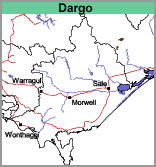
Dargo (Do)
|
|
Geology
Ordovician-silurian granodiorite. The boundary on the soil map was established on the basis of the geological map and contour information. The underlying rocks are similar to those underlying the Timbarra map unit but the topography is of lower relief.
Landform
Undulating to rolling hills.
Soils
Three soil profiles have been examined on this mapping unit by Aldrick et al. (1992). Decomposing rock (granite) was encountered less than 1 m from the surface and all surface soils were dark brown sandy loams with a pH of around 6.0. The subsoils, which occurred between 25 and 50 cm, were red or brown medium clays or sandy clays with pH’s around 6.5 to 7.0. All soils were non-sodic and all have a relatively high cation exchange capacity.
Land Management
The soils on this unit are particularly prone to gully erosion on the valley floors and on steep upper slopes. The upper slopes are also prone to sheet and rill erosion if overgrazed. The surface soils are naturally high in potassium, but phosphorus is generally low. As the pH is above 6.0 lime additions are unnecessary.
Land Use
The area is mostly cleared and is mainly grazed by cattle and sheep on improved and native pastures.
© State of Victoria (Agriculture Victoria) 1996 - .

This work, Victorian Resources Online, is licensed under a Creative Commons Attribution 4.0 licence. You are free to re-use the work under that licence, on the condition that you credit the State of Victoria (Agriculture Victoria) as author, indicate if changes were made and comply with the other licence terms.
The licence does not apply to ‘branding’ or some ‘images or photographs’ that may be owned by third parties. We ask you to seek prior approval to use images using the VRO feedback form. Access to higher quality images can also be provided on request.
This page was last updated on .