
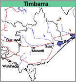
Timbarra (Ta)
 |
Geology
Ordovician-silurian granodiorite. The map boundary was drawn on the basis of radiometric data as well as the geological map. As a result some highly metamorphosed sediments e.g. mica schists, may be included in this unit. The underlying rocks are similar to those underlying the Dargo map unit but the topography is much steeper. Accordingly, this map unit has remained largely uncleared.
Landform
Rolling to steep hills.
Soils
No soil profiles were examined. Rock outcrops were noted. If a sufficiently deep soil is formed, it is likely to be brown sandy clay loam overlying a brown or red medium clay (sandy).
Land Management
There is insufficient land which is cleared to make comments on land management issues.
Land Use
Mostly uncleared. Small areas are grazed.
© State of Victoria (Agriculture Victoria) 1996 - .

This work, Victorian Resources Online, is licensed under a Creative Commons Attribution 4.0 licence. You are free to re-use the work under that licence, on the condition that you credit the State of Victoria (Agriculture Victoria) as author, indicate if changes were made and comply with the other licence terms.
The licence does not apply to ‘branding’ or some ‘images or photographs’ that may be owned by third parties. We ask you to seek prior approval to use images using the VRO feedback form. Access to higher quality images can also be provided on request.
This page was last updated on .