
16. Pakenham - Toomuc Creek Incision
|
This information has been developed from one or more of these publications:
|
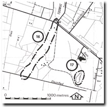
| Location: | Pakenham – 650855. One kilometre west of Pakenham between the Princes Highway and the Gippsland Railway line. | |
| Access: | From the Princes Highway. | |
| Ownership: | Crown Land. (Public Land River Reserve). | |
| Geology/Geomorphology: | As with the Cardinia Creek section described below in more detail (Site 18), this section of Toomuc Creek has recently widened and deepened its channel since drainage of swamplands to the south. | |
| Significance: | Regional. The site is an example of the impact of the drainage of the swamplands on channel morphology. | |
| Management: | Class 3. Erosion control measures may be necessary to reduce the erosion hazard at the site, and these would not alter the significance rating. | |

© State of Victoria (Agriculture Victoria) 1996 - .

This work, Victorian Resources Online, is licensed under a Creative Commons Attribution 4.0 licence. You are free to re-use the work under that licence, on the condition that you credit the State of Victoria (Agriculture Victoria) as author, indicate if changes were made and comply with the other licence terms.
The licence does not apply to ‘branding’ or some ‘images or photographs’ that may be owned by third parties. We ask you to seek prior approval to use images using the VRO feedback form. Access to higher quality images can also be provided on request.
This page was last updated on .