
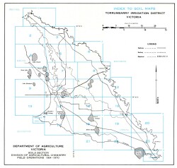
Torrumbarry
The report: 'Soils and Land Use in the Torrumbarry Irrigation District Victoria' was published by the Department of Agriculture in 1979 by Ian Sargeant, Jim Newell and Irwin Walbran. It is a detailed survey of approximately 127 000 hectares of farm land in parts of the counties of Gunbower and Tatchera near Kerang and was carried out by a team of Department of Agriculture soil surveyors. A downloadable version of the report is available below.
To view the information PDF requires the use of a PDF reader. This can be installed for free from the Adobe website (external link).
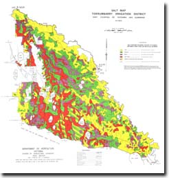
 | (PDF 1,126KB) | |
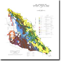 Soil Association Map - Torrumbarry Irrigation District (PDF 1.56MB) | ||
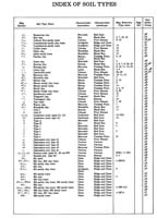
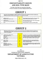
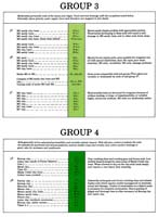
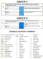
Key to Crop-Suitability Groups and Soil type Maps | ||
© State of Victoria (Agriculture Victoria) 1996 - 2025.

This work, Victorian Resources Online, is licensed under a Creative Commons Attribution 4.0 licence. You are free to re-use the work under that licence, on the condition that you credit the State of Victoria (Agriculture Victoria) as author, indicate if changes were made and comply with the other licence terms.
The licence does not apply to ‘branding’ or some ‘images or photographs’ that may be owned by third parties. We ask you to seek prior approval to use images using the VRO feedback form. Access to higher quality images can also be provided on request.
This page was last updated on 23/03/2020.