
Stillards Loam
Stillards Loam is the lowest member of the catena (slope sequence of hill soils) and is yellow in colour. The gentle to moderate slopes make the soil type externally well drained. The soil type appears to develop on parts of the hills receiving extra water from surface runoff.
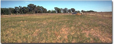 Typical landscape associated with the Stillards Loam mapping unit. |
Typical Profile
| Surface | ||
| A1 | 0-20 cm | Dark dull brown (10YR4/4) to grey-brown loam sometimes increasing to clay loam; 15 to 35 cm thick; where thicker than 20 cm the horizon has been differentiated into a surface horizon as above, and a brown (7.5YR5/6) or yellowish brown diffusely mottled subsurface; slight buckshot irregularly present; usually grading to: |
| Subsoil | ||
| B21 | 20-75 cm | Brown or yellowish brown diffusely mottled clay, usually increasing somewhat in texture with depth, and becoming more yellow at about 40 cm; crumbly when moist; scattered buckshot; sharply separated from: |
| B22 | 75-120 cm | Grey and yellowish brown or brown mottled clay; dense, well organised usually breaking up into small, distinct peds when moist; scattered black inclusions; trace of calcium carbonate irregularly present. |
Soil Pit Site NE5 is an example of a soil in the Stillards Loam mapping unit. This soil is classified as a Yellow DERMOSOL using the Australian Soil Classification.
Variations
The subsoil extends down to depths varying from 70 to 115 cm. On the steeper slopes, the soils included in the type are more variable.
An occasional quartz floater may be found in the profile. The surface horizon can be sandy, or even gritty, and in some instances it is differentiated into an A1 horizon and a moderately bleached A2 horizon. Soils with grey and grey mottled horizons, found in some parts where surface runoff concentrates, have also been included in the type.
Relationship to Other Soil Types
Stillards Loam is similar in its profile features to the Brown and Normal Phases of Rutherglen Loam. It is separated from the latter only on its position in the landscape. These soil types commonly adjoined each other, and where the hills merge into the plain, the soil boundary often has been drawn rather arbitrarily on the change in slope.
© State of Victoria (Agriculture Victoria) 1996 - .

This work, Victorian Resources Online, is licensed under a Creative Commons Attribution 4.0 licence. You are free to re-use the work under that licence, on the condition that you credit the State of Victoria (Agriculture Victoria) as author, indicate if changes were made and comply with the other licence terms.
The licence does not apply to ‘branding’ or some ‘images or photographs’ that may be owned by third parties. We ask you to seek prior approval to use images using the VRO feedback form. Access to higher quality images can also be provided on request.
This page was last updated on .