
Sandy Inlet
Erosion beside Lake Hume at full supply level in the embayment of Sandy Creek (Sandy Inlet Site No. 10), has exposed the surface of a hardpan with a polygonal crack-infill pattern similar to the Tallangatta hardpan. This appears to be formed in piedmont sediments. Apparently, the coarse river gravels of the Tallangatta foreshore and Hillsbrae sites were not deposited at this level in this tributary valley. On the piedmont slope above this site, the Murray Valley Highway cuts through several low rises and exposes typical Tallangatta Hardpan at about a metre below the surface (Site No. 11).
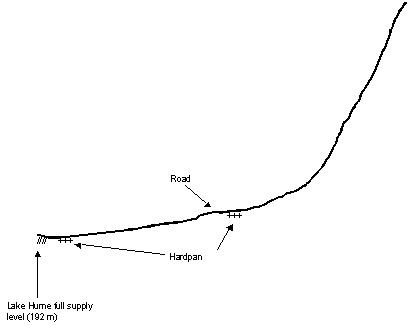
Figure 2a: Cross section of the piedmont, in the valley of the Mitta River at Sandy Inlet.
© State of Victoria (Agriculture Victoria) 1996 - .

This work, Victorian Resources Online, is licensed under a Creative Commons Attribution 4.0 licence. You are free to re-use the work under that licence, on the condition that you credit the State of Victoria (Agriculture Victoria) as author, indicate if changes were made and comply with the other licence terms.
The licence does not apply to ‘branding’ or some ‘images or photographs’ that may be owned by third parties. We ask you to seek prior approval to use images using the VRO feedback form. Access to higher quality images can also be provided on request.
This page was last updated on .