
Branxholme Land System
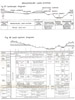 | Branxholme Land System - Figures 37 & 38 (PDF - 176KB) To view the information PDF requires the use of a PDF reader. This can be installed for free from the Adobe website (external link). |
Extending westwards from Melbourne to Hamilton, a distance of about two hundred miles, large areas of volcanic plains form the third most extensive cntinuous sheet of basalt in the world. I is made upup of a number of flows, the earliest of which was extruded during the late Pliocene. In parts, this earliest flow has been moderately dissected and areas where the dissection has been deep enough to expose underlying rocks have been mapped as the Branxholme land-system, which may be briefly characterised as the rolling country carved out of the volcanic plains of the far Western District. Where the basalt, the Hamilton flow, has not been dissected sufficiently deeply, the landscape has been mapped as the allied Hamilton land-system.
Geomorphology
An escarpment sometimes marks the boundary of dissected areas, especially if the dissection be deep, and such a boundary is precise as near Knebsworth, cast of Condah, cast of MacArthur and around Arrandoovong. Elsewhere, the escarpment is lacking and a continuous slope stretches from a zone of kaolinitic weathering which caps the basalt, to the valley floor beneath the level of the basalt. Boundaries are then arbitrary and some of the basalt could be included within either the Branxholme or Hamilton land-system.
Rocks exposed beneath the basalt are varied and in many places their identity could not be readily ascertained. Laterite is presumed to underlie the basalt in many areas, particularly in northern parts of the land-system because there the extrusive basaltic landscape is slightly higher than the flat lateritised tableland nearby which, it is inferred, continues beneath the basalt for an uncertain distance.
No sections showing the basalt undoubtedly overlying laterite have been observed yet, but a number of examples show soil which is apparently derived from laterite at positions just beneath the basalt escarpment. In the Morven land-unit, the beds exposed are probably the Mesozoic Merino Group because the area is adjacent to a catchment in which they have been mapped and some of the soils encountered are similar to the Whyte series found on such beds elsewhere. Consolidated sandy rocks are found in the Branxholme and MacArthur land-units and these are probably Tertiary in age. Late Tertiary deposits (Miocene and early PlioceneGill 1957) are exposed in the Yulecart land-unit and Miocene limestone has been observed just south of Branxholme. Quaternary fill-deposits are deep in most valleys and the rocks contributing to these are varied, probably including basalt, laterite, sandy sediments and calcareous deposits of a range of textures.
Soils
Soils are as varied as the parent materials and topography.
Normanby family solodic soils are restricted to those parts of the land-system where the slopes are on basalt or to some lower topographic position influenced by basalt. They are more prevalent in the Morven land-unit and the southern part of the Yulecart land-unit on fairly gentle slopes which shelve away from the basalt peneplain. In these land-units, prairie soils and chernozems occupy the lower topographic positions in the long gentle parallel valleys and may be derived in part from Mesozoic sediments. Over the Branxholme and MacArthur land-units, however, solodic soils predominate which have coarse sandy loam A horizons and are not of the Normanby family. There are local areas of red solodic soils evidently associated with lateritic outcrops and small occurrences of the Normanby family. Prairie soils or chernozems are characteristic of the valley floors, terraces and the creek-lines which extend up the slopes ; these latter soils grade into peats in the drainage lines at low positions. As in the Hamilton land-system, where the areas of peat or peaty prairie soils are big enough, they have been mapped as the Condah Swamp land-system. The two chief examples of this within the Branxholme land-unit are the Condah Swamp itself and the Louth Swamp, and they occupy parts of major drainage lines which have been blocked by the basalt flows from Mount Eccles and Mount Napier respectively. These areas of the Condah Swamp land-system are continuous with the narrow bands of peat or peaty prairie soils ramifying up various valleys in the Branxholme land-system itself.
No chemical analyses of soils from this land-system have been done. Examples from other land-systems of soils of the Normanby family and prairie soils show moderate and high levels respectively of most plant nutrients and these results almost certainly apply to similar soils in the Branxholme land-system. Sandy solodic soils are known to require phosphorus for their successful development and are probably inferior to the Normanby family in nutrient status and structure.
There are small salt patches in or fringing drainage lines and the high salt content of the peat sample from Condah Swamp demonstrates the substantial amount which must have moved in from the catchment in the Branxholme land-unit. Further extension of the salting will depend on the extent of water use in the catchment by vegetation. This may have already reached a low level, as widespread clearing took place some time ago; however, if improved pastures, which are continually increasing, deteriorate and develop a high proportion of short-lived species, then the resulting low water-use may lead to a greater tendency to salting.
Vegetation
In many respects, the original vegetation over most of the landscape closely resembled that of the Hamilton land-system. The chief community was one or other of the associations of the Eucalyptus ovata (swamp gum) alliance in either tall woodland or savannah woodland formation. As in the Hamilton land-system red gum (E. camaldulensis) was present towards the north. Also, towards the north and north-west of both land-systems, the density of the timber appears to have been less than elsewhere; this was especially so on the heavier soils of the lower slopes where the sparse timber thinned out in places to a grassland. The characteristic timber of the bulk of both land-systems however, was a tall woodland of swamp gum and other species.
The main difference between the vegetation of the two land-systems was in the minor tree species associated with swamp gum and in the greater range of plant communities resulting from the greater range of topographic position. On the solodic soils of the Normanby family in the Hamilton land-system and also where these soils occur in the Branxholme land-system, there was a tall woodland of swamp gum with blackwood (Acacia melanoxylon) or lightwood (Acacia implexa) and sometimes a little she-oak (Casuarina stricta), honeysuckle (Banksia marginata) and wild cherry (Exocarpus cupressiformis). On the solodic soils derived from sandy sediments however, which are the more common soils in the Branxholme land-system, it seems from the old records that blackwood or lightwood was absent and she-oak and honeysuckle more abundant. Furthermore, although wet scrubs of tea-tree (Melaleuca pubescens) occasionally occupied the wetter drainage lines in the Hamilton land-system, they were much more common in the southern parts of the Branxholme land-system where the rainfall is more than 28 inches and in fact were typical of the drainage lines. They still remain in many places. In this feature is seen the affinity with the wetter areas further south as around Heywood where such vegetation is widespread and contrasts with similar landscape positions further north where grasslands were characteristic.
More specifically, the vegetation over most of the Branxholme and MacArthur land-units was originally a tall woodland in which swamp gum was the dominant species. On solodic soils derived from sandy materials she-oaks and honeysuckle were the associated minor species whilst on the smaller areas of solodic soils derived from clayey materials, or on the heavier textured soils in lower positions, blackwood or lightwood were the associated minor species. The density of timber was less on heavier soils in lower positions, forming a savannah woodland. Scrubs of tea-tree characterised the drainage lines in southern parts of these land-units with average annual rainfalls more than 28 inches. In the Morven land-unit, tall or savannah woodlands of swamp gum with blackwood probably occupied the slopes and grasslands the drainage lines; in the Yulecart land-unit with an average of 26-27 inches annual rainfall, red gum and swamp gum intermixed in a savannah woodland formation.
Much of this estimate of the original state of the vegetation in the Branxholme land-system has been pieced together from a study of the old parish plans together with the observation of vegetation which still remains. On this estimate there must have been the same widespread clearing of timber without regeneration as in the Hamilton land-system, for little remains now except the tea-tree scrubs.
Land-use
The early history of land-use was much the same as in the Hamilton land-system. The grasslands produced after clearing carried Merino flocks on relatively few large properties.
The pattern has gradually changed, particularly in the Branxholme and MacArthur land-units, with a swing awat from Merino wool growing toward cross-bred wool growing, but not towards fat lambs. On some properties, beef cattle raising has become important and there is sonic fodder cropping and cash cropping.
These changes point the way to a greater intensification of land-use throughout the land-system, made necessary by increasing pressure on the land and greater subdivision of the properties. All the land-units have a potential for cross-bred wool growing and beef cattle raising on late annual and perennial improved pastures; in southern parts, cross-bred wool growing with fat lambs on perennial pastures is possible and dairying on the wetter parts of the landscape. Beef cattle raising particularly, with a relatively hardy breed like the Hereford, has considerable possibilities. These land-use systems require fodder conservation and fodder cropping; cash cropping also is practicable. Problems exist with the more intensive land-use, such as the more exacting cultivation requirements on the solodic soils in the comparatively wet winter and spring as compared with drier areas. In general, the land-use potential is similar to that of the Hamilton land-system, but a little more diverse.
Erosion
Contrary to the situation in the Hamilton land-system, soil erosion in the Brauxholme land-system cannot be dismissed as light. Moderate sheet erosion exists throughout the land-system but is being diminished with increasing pasture improvement. The resulting surface run-off, together with some from the Hamilton land-system, has not produced widespread gullying as in the Glenelg land-system nor deep gullying of most drainage lines as in the Casterton land-system. However, some deep and wide gullies have been formed. It is a feature of the land-system, as well as of the sloping parts of the north-western areas of the Hamilton land-system, that most of them run quite straight and, clearly, are entrenched in old drains. It seems that the hazard of gully erosion is not so severe as in the Casterton land-system, because of better rainfall and more gentle and shorter slopes, so that gullies only originate from man-made drains. Nevertheless, where these drains have been made, the same processes of slumping as operate in the gullies of the Casterton land-system can produce the same startling results because soils in such low-lying areas are similar. Fundamentally the answer to the problem is the establishment of better cover on the catchment and diversion of run-off from the drains with subsequent disposal at safe points.
Salt patches are found at the bottom of some slopes and these probably would have been more severe had the soils in the lower positions been solodic soils rather than the prairie soils, chernozems and peats which they usually are. Amelioration of the salting is a matter of fencing off the salt patches, drainage and sowing the appropriate species.
Summary
Branxholme land-system is the rolling and undulating country where dissection of the earliest basalt flow of the Western District volcanic plains exposes underlying rocks. The chief soils are solodic soils including a minority of the Normanby family, with prairie soils, chernozems and sometimes peats in drainage lines. As in the Hamilton land-system, which forms the adjoining undulating plateaux, tall woodlands mainly of swamp gum were once widespread, but with grasslands or scrubs of tea-tree in the lower positions of the landscape. These woodlands were destroyed and replaced by grasslands of native grasses which supported Merino wool growing. The land is capable of being used more intensively for cross-bred wool growing, fat lambs, beef cattle raising and cash cropping; dairying is practicable in the south. On some properties this potential is being developed. Sheet erosion has been widespread and there is some gullying in old drains. In general, the greatest affinities of the Branxholme land-system are with the Hamilton land-system, but the features and potential of the former are somewhat more diverse.
© State of Victoria (Agriculture Victoria) 1996 - .

This work, Victorian Resources Online, is licensed under a Creative Commons Attribution 4.0 licence. You are free to re-use the work under that licence, on the condition that you credit the State of Victoria (Agriculture Victoria) as author, indicate if changes were made and comply with the other licence terms.
The licence does not apply to ‘branding’ or some ‘images or photographs’ that may be owned by third parties. We ask you to seek prior approval to use images using the VRO feedback form. Access to higher quality images can also be provided on request.
This page was last updated on .