
Soils of the Rises
Back to: Hamilton Research Institute - Soils
The pattern of the soils across the Institute relate particularly well to their landscape position. For example, the upper subsoil is usually yellowish brown and mottled on lower slopes and browner in higher parts of the landscape. Also, the depth and degree of subsurface (A2) horizon bleaching, is usually greater on the lower slopes reflecting a less well drained landscape position. In general, it seems that the soil profiles in lower sloped landscape positions, have relatively higher amounts of exchangeable sodium that may have accumulated over time. The soils can be categorised into three groups: crest phase, slope phase and valley flats.
Crest Phase
Sites PVI6 and PVI8 are examples of the crest phase on low rises. In some cases e.g. PVI6, the weathered basalt is within a metre of the soil surface. These soil profiles are non-sodic and the upper subsoils are relatively well structured, parting to medium to fine sized polyhedral aggregates.
Slope Phase
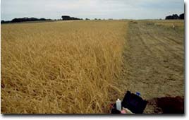
Sites PVI1, PVI2 , PVI3 and SFS15 are located within one paddock on the lower slope of a low rise. These sites show variations in soil profile features across the paddock and display some gilgai micro-relief. The land surface around the SFS15 site is moderately gilgaied, with 'puffs' (mounds) at 2-4 metre intervals and a relative relief of 10 cm or less between mounds and hollows.
Variations in soil profile features associated with the gilgai micro-relief include:
- variations between yellow and brown coloured upper subsoil,
- variations in levels of exchangeable sodium percentage (ESP) in the upper subsoil from non-sodic to marginally sodic,
- depth and degree of bleaching in the subsurface (A2) horizons, with deeper and more bleached A2 horizons associated with gilgai hollows,
- depth to, and amount of, ferruginous nodules in the surface, subsurface and upper subsoil horizons.
PVI7 is also an example of a soil within the slope phase.
Valley Flats
Site PVI9 is an example of valley flat situation where some finer materials have accumulated in the profile. Note, for example, the relatively high fine sand and silt contents in the surface horizons 70-80% and in the upper subsoil 60%. Variations in soil profiles such as depth of surface horizons, are also likely in these situations due to possible incipient gilgai micro-relief. In areas where gilgai micro-relief occurs, the subsoils will display some vertic properties i.e. occurrence of slickensides and/or lenticular peds in the deeper subsoil.
© State of Victoria (Agriculture Victoria) 1996 - .

This work, Victorian Resources Online, is licensed under a Creative Commons Attribution 4.0 licence. You are free to re-use the work under that licence, on the condition that you credit the State of Victoria (Agriculture Victoria) as author, indicate if changes were made and comply with the other licence terms.
The licence does not apply to ‘branding’ or some ‘images or photographs’ that may be owned by third parties. We ask you to seek prior approval to use images using the VRO feedback form. Access to higher quality images can also be provided on request.
This page was last updated on .