Soil Survey of Part of County Moira Victoria
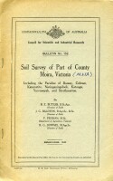
A soil survey of part of the former County Moira, Victoria, that was to be supplied with water for irrigation from the Murray River, commenced in 1938 by B E Butler, J G Baldwin, F Penman and R G Downes of the former Council for Scientific and Industrial Research (now CSIRO). This historic bulletin, published in 1942 covers the work on the eastern portion that comprised seven parishes; the remaining parishes of the projected area were to be included in a subsequent survey.
We gratefully acknowledge permission to make this report available from CSIRO (external link)
To view the information PDF requires the use of a PDF reader. This can be installed for free from the Adobe website (external link).
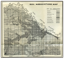
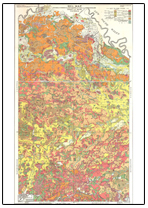
 |  Soil Associations Map (PDF 595KB) |  Soil Map (PDF 635KB) |

