
Landform
|
|
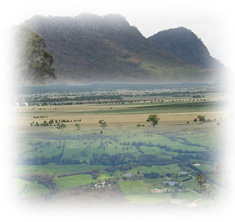
These units form the basis of the Land Systems of Victoria, and are currently under review by the Geomorphology Reference Group. The geomorphic units that form the basic components of the land systems of the Corangamite region are listed in the Table below. | PDF version 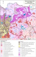 Goulburn Broken Region Geomorphological Unit Types (PDF 1.3MB) To view the information PDF requires the use of a PDF reader. This can be installed for free from the Adobe website (external link). |
Geology Information
Geoscience Victoria's web mapping application allows users to search geospatial databases and display the results as maps or tables. Datasets that can be viewed and interrogated include mineral, petroleum and extractive industries tenements, land-use and airborne geophysical survey boundaries, gravity, magnetic and radiometric images, bore hole & well data, surface geochemistry results, mines and mineral occurrences, and geological maps and interpretations at various scales.

© The State of Victoria, 1996 - .
This page was last updated on .