
B 3.8 Low hills and Hills, Granitic, Type 1
LuGh1, HsGm1, HsGh1
Soils: Dominant: Gn4.11, Gn4.31, Gn3.11. Red/brown gritty, friable gradational profiles, weakly to moderately well structured, shallow to deep on upper and mid slopes, particularly where moist. Duplex moderately to deep soil profiles occur on lower slopes. Moderately to strongly structured subsoils (sandy clay loam) occur particularly on lower (colluvial) topographic positions, with a sandy component including quartz, and may be mottled throughout. Weakly structured A horizons (sandy loam) with coarse fraction component throughout and on organic surface horizon.
Minor: Uc, Gn. Uniform and gradational profiles which have developed in close association with bedrock (granitic) and limited depth. These are generally coarse, with only partial breakdown of the granitic parent material.
Native vegetation: Predominantly Lowland Sclerophyll Forest and Riparian Forest with greater growth and species diversity on lower and sheltered slopes; aspect, slope and topographic position being important determining factors for variation in vegetation growth. White Ash (E. fraxinoides) is found on the Howe Range.
Stone/rock outcrop: Crest and upper slope of the steep hill unit (HsGh1).
Pans: No pans observed.
Land use: Conservation and recreation within the Croajingolong National Park and some hardwood production in State Forest. Some minor clearing on lower slope associated with sparse settlement.
Observed land deterioration: Sheet erosion and rock weathering where exposed and vegetation cover is thin.
Susceptibility to land deterioration: Sheet and rill erosion (moderately low to high); Gully erosion (moderately low to high depending on vegetation cover and topographic position); Compaction (moderately low to high); Mass movement (low to moderate); Inundation/Waterlogging (low to moderately high).
Sites with laboratory data: 202.
Page top
| There are only two units in this category which relate to a specific pluton of granitic material that form the Howe Range east of Mallacoota. The separation of granitic parent materials is based on the differentiations used by the Geological Survey as published on the 1:250 000 Mallacoota geology sheet. The main map unit is the steep Hill unit which falls within the humid climatic category and as with many granitic map units there is some surface rock outcrop, particularly on the crests and upper slopes. Here there are friable, gritty gradational soil profiles and a variety of vegetation, generally lowland and Riparian Sclerophyll Forest. The Low hills undulating granitic unit has more developed soils with duplex profiles and variable vegetation coverage and size depending on topographic position and aspect. Geology: Dgr; Devonian granite (Gabo Island Granite). Red biotite granite. Rainfall: 1000-1200 mm per annum. Slope: Variable; 3-56%, generally 32-56%. Dominant landform element: Slope. Minor landform element: Crest, depressions. | 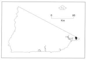 |
Soils: Dominant: Gn4.11, Gn4.31, Gn3.11. Red/brown gritty, friable gradational profiles, weakly to moderately well structured, shallow to deep on upper and mid slopes, particularly where moist. Duplex moderately to deep soil profiles occur on lower slopes. Moderately to strongly structured subsoils (sandy clay loam) occur particularly on lower (colluvial) topographic positions, with a sandy component including quartz, and may be mottled throughout. Weakly structured A horizons (sandy loam) with coarse fraction component throughout and on organic surface horizon.
Minor: Uc, Gn. Uniform and gradational profiles which have developed in close association with bedrock (granitic) and limited depth. These are generally coarse, with only partial breakdown of the granitic parent material.
Native vegetation: Predominantly Lowland Sclerophyll Forest and Riparian Forest with greater growth and species diversity on lower and sheltered slopes; aspect, slope and topographic position being important determining factors for variation in vegetation growth. White Ash (E. fraxinoides) is found on the Howe Range.
Stone/rock outcrop: Crest and upper slope of the steep hill unit (HsGh1).
Pans: No pans observed.
Land use: Conservation and recreation within the Croajingolong National Park and some hardwood production in State Forest. Some minor clearing on lower slope associated with sparse settlement.
Observed land deterioration: Sheet erosion and rock weathering where exposed and vegetation cover is thin.
Susceptibility to land deterioration: Sheet and rill erosion (moderately low to high); Gully erosion (moderately low to high depending on vegetation cover and topographic position); Compaction (moderately low to high); Mass movement (low to moderate); Inundation/Waterlogging (low to moderately high).
Sites with laboratory data: 202.
© State of Victoria (Agriculture Victoria) 1996 - .

This work, Victorian Resources Online, is licensed under a Creative Commons Attribution 4.0 licence. You are free to re-use the work under that licence, on the condition that you credit the State of Victoria (Agriculture Victoria) as author, indicate if changes were made and comply with the other licence terms.
The licence does not apply to ‘branding’ or some ‘images or photographs’ that may be owned by third parties. We ask you to seek prior approval to use images using the VRO feedback form. Access to higher quality images can also be provided on request.
This page was last updated on .