
B 3.46 Mountains, Volcanic, Type 2
MsVm2, MvVm2, MvpVm2
Soils: Dominant: Gn4.51, Gn3.91, Um. Shallow to moderately deep, hardsetting occasionally friable gradational and uniform profiles (loam A horizons over clay loam B horizons) with low to moderate organic levels in the A horizon. Profiles are generally stony especially on the drier slopes and shallower soils (depending on topographic position and aspect), and often have a coarse component throughout.
Minor: Gn4.31, Dy, Db. Shallow to deep friable gradational profiles, moderately to strongly structured often with coarse component and found in moister areas, generally lower slopes and areas of moisture accumulation. Minor duplex soil profile occurrences found on lower drier slopes.
Native vegetation: Predominantly Dry Sclerophyll Forest, Wet Sclerophyll Forest, Riparian Forest and Rainshadow Woodland: Silvertop, White Stringybark, Silver Wattle, Messmate, Mountain Grey Gum, Blackwood, Blanket-leaf, Dogwood, Manna Gum and White Box.
Stone/rock outcrop: Moderate to high stone/rock outcrop particularly on upper slopes and drier aspects.
Pans: Nil or not observed
Land use: Public land with varying amounts of tree cover, given aspect, topographic position and rock outcrop. These units are within the Snowy River National Park and have minimal formed access.
Observed land deterioration: Some sheet erosion
Susceptibility to land deterioration: Sheet and rill erosion (moderate to very high); Gully erosion (moderately low to high); Compaction (moderately low to moderately high). Higher for deeper, clayey profiles; Inundation/Waterlogging (very low to moderate); Mass movement (moderately low to very high).
Sites with laboratory data: Nil
Page top
| These units are based on the Snowy River Volcanics geological formation which have a number of lithologies; predominantly acid volcanics (rhyodacite). The Type 2 units generally consist of a greater proportion of red ignimbrite, and some coarse sandstone and conglomerate compared with Type 1 and 3 units and are generally drier. These units may continue west of the Snowy River (study boundary) in places. The soils tend to range from friable brown gradational profiles in moister areas to hardsetting and stony gradational, uniform profiles occasionally duplex on lower slopes with greater soil accumulation. The vegetation is Dry Sclerophyll Forest, Wet Sclerophyll Forest, Rain-shadow Woodland and Riparian Forest. Geology: Dls; Devonian acid volcanics (Snowy River Volcanics). Rhyodacite, tuff, andesite, minor rhyolite and basalt. Also includes coarse sandstone and conglomerate, minor siltstone. Rainfall: Less than 700-1000 mm per annum. Slope: 32- greater than 100%, generally 32-56% Dominant landform element: Slope, scarp Minor landform element: Drainage depression | 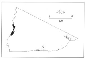 |
Soils: Dominant: Gn4.51, Gn3.91, Um. Shallow to moderately deep, hardsetting occasionally friable gradational and uniform profiles (loam A horizons over clay loam B horizons) with low to moderate organic levels in the A horizon. Profiles are generally stony especially on the drier slopes and shallower soils (depending on topographic position and aspect), and often have a coarse component throughout.
Minor: Gn4.31, Dy, Db. Shallow to deep friable gradational profiles, moderately to strongly structured often with coarse component and found in moister areas, generally lower slopes and areas of moisture accumulation. Minor duplex soil profile occurrences found on lower drier slopes.
Native vegetation: Predominantly Dry Sclerophyll Forest, Wet Sclerophyll Forest, Riparian Forest and Rainshadow Woodland: Silvertop, White Stringybark, Silver Wattle, Messmate, Mountain Grey Gum, Blackwood, Blanket-leaf, Dogwood, Manna Gum and White Box.
Stone/rock outcrop: Moderate to high stone/rock outcrop particularly on upper slopes and drier aspects.
Pans: Nil or not observed
Land use: Public land with varying amounts of tree cover, given aspect, topographic position and rock outcrop. These units are within the Snowy River National Park and have minimal formed access.
Observed land deterioration: Some sheet erosion
Susceptibility to land deterioration: Sheet and rill erosion (moderate to very high); Gully erosion (moderately low to high); Compaction (moderately low to moderately high). Higher for deeper, clayey profiles; Inundation/Waterlogging (very low to moderate); Mass movement (moderately low to very high).
Sites with laboratory data: Nil
© State of Victoria (Agriculture Victoria) 1996 - .

This work, Victorian Resources Online, is licensed under a Creative Commons Attribution 4.0 licence. You are free to re-use the work under that licence, on the condition that you credit the State of Victoria (Agriculture Victoria) as author, indicate if changes were made and comply with the other licence terms.
The licence does not apply to ‘branding’ or some ‘images or photographs’ that may be owned by third parties. We ask you to seek prior approval to use images using the VRO feedback form. Access to higher quality images can also be provided on request.
This page was last updated on .