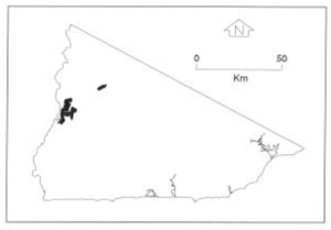
B 3.45 Mountains, Volcanics, Type 1
MrsVm1, MsVm1, MsVh1, MvVm1
Soils: Dominant: Gn4.11, Gn4.31, Gn3.11, Gn3.71. Friable, shallow to deep, moderately to strongly (finely) structured gradational profiles with a gritty, coarse component through the profile of loam A horizons over clay loam B horizons. There is an organic rich surface horizon, particularly in the moister areas.
Minor: Gn4.51, Gn3.71, Gn3.91 Um/Uc. Shallow to moderately deep, deep gritty often harder setting (drier) than the dominant soil type. Moderately well structured with variable stone/gravel content. Depositional multilayered profiles (coarse, medium and fine textures) are associated with drainage lines and lower slopes.
Native vegetation: Predominantly Wet Sclerophyll Forest, Dry Sclerophyll Forest with Riparian Forest; Messmate, Mountain Grey Gum, Narrow-leaved Peppermint, minor occurrences of Brown Barrel, Blackwood, Blanket-leaf, Rough Tree-Fern, White Stringybark, Hazel Pomaderris and Austral bracken.
Stone/rock outcrop: Low to moderate. Stone and some outcrop on the steeper slopes, especially upper slopes and some crests.
Pans: Nil or not observed
Observed land deterioration: Minimal observation; sheet erosion.
Susceptibility to land deterioration: Sheet and rill erosion (moderately low to very high); Gully erosion (low to high); Compaction (moderately low to moderately high); Inundation/Waterlogging (very low to moderate); Mass movement (low to high).
Sites with laboratory data: Nil
Page top
| These units are based on the Snowy River Volcanics geological formation which have a number of lithologies, but are predominantly acid volcanics (rhyodacite). This group of units comprises of the steeper slopes and higher relief along and to the east of the Rodger River. There is also one Mountain unit to the east in the upper reaches of the Rodger River. The general rainfall pattern shows a decrease to the west from the middle section of the Rodger River. However topographic position and aspect are important factors in altering this generalisation. The soils are generally friable gradational profiles often shallow and stony with greater accumulation on footslopes and nearer drainage lines. The vegetation is predominantly Wet Sclerophyll Forest but Dry Sclerophyll Forest and Riparian Forest also occur. Geology: Dls; Devonian acid volcanics (Snowy River Volcanics). Rhyodacite, tuff, andesite, minor rhyolite and basalt. Also includes coarse sandstone and conglomerate, minor siltstone (minimal in Type 1 map units). Rainfall: 700-1200 mm per annum Slope: 10-100%, generally 32-56% Dominant landform element: Slope Minor landform element: Drainage depression |  |
Soils: Dominant: Gn4.11, Gn4.31, Gn3.11, Gn3.71. Friable, shallow to deep, moderately to strongly (finely) structured gradational profiles with a gritty, coarse component through the profile of loam A horizons over clay loam B horizons. There is an organic rich surface horizon, particularly in the moister areas.
Minor: Gn4.51, Gn3.71, Gn3.91 Um/Uc. Shallow to moderately deep, deep gritty often harder setting (drier) than the dominant soil type. Moderately well structured with variable stone/gravel content. Depositional multilayered profiles (coarse, medium and fine textures) are associated with drainage lines and lower slopes.
Native vegetation: Predominantly Wet Sclerophyll Forest, Dry Sclerophyll Forest with Riparian Forest; Messmate, Mountain Grey Gum, Narrow-leaved Peppermint, minor occurrences of Brown Barrel, Blackwood, Blanket-leaf, Rough Tree-Fern, White Stringybark, Hazel Pomaderris and Austral bracken.
Stone/rock outcrop: Low to moderate. Stone and some outcrop on the steeper slopes, especially upper slopes and some crests.
Pans: Nil or not observed
Observed land deterioration: Minimal observation; sheet erosion.
Susceptibility to land deterioration: Sheet and rill erosion (moderately low to very high); Gully erosion (low to high); Compaction (moderately low to moderately high); Inundation/Waterlogging (very low to moderate); Mass movement (low to high).
Sites with laboratory data: Nil


