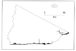
B 3.43 Mountains, Sedimentary, Type 8
MsSh8, MsSv8, MvSv8
Soils: Dominant: Gn4.31, Gn3.71, Gn3.11, Gn4.11. Friable organic gradational profiles, brown, occasionally red with moderately well structured horizons though more dense in the B horizons (occasionally strongly structured) with occasional minor mottling loam/clay loam A horizon over silty clay/medium clay. There is often a fine sandy component throughout (with schistose material). Depth varies with topographic position and aspect to a lesser extent.
Minor: Shallow to moderately deep, less moist gradational profiles which can be hardsetting and less organic matter. Deep colluvial (accumulation) profiles may have some duplex characteristics such as an increasingly sharp textured change (medium clay B horizon with depth) and a reduction in structural organisation in the lower A horizon, particularly on drier sites and aspects.
Native vegetation: The vegetation is predominantly Wet Sclerophyll Rainforest with Warm Temperate Rainforest and Riparian Vegetation: Brown Barrel, Messmate, Mountain Grey Gum, Silver Wattle, Smooth Tree-Fern, Rough Tree-Fern, River Peppermint, Long-leafed Dogwood, Hazel Pomaderris and Blanket-leaf. Minor Dry Sclerophyll Forest includes Silvertop, and White Stringybark with a similar understorey to the Wet Sclerophyll Forest.
Stone/rock outcrop: Minor to moderate; greatest on upper slopes especially drier aspects.
Pans: Nil or not observed.
Land use: Forested, designated State Forest and therefore available for timber harvesting, however there is a stream reserve around the Goolengook River. There is an abandoned mine (Bola Mine) off Barrs Road.
Observed land deterioration: Minor sheet and rill erosion with some creep, greater where disturbed for clearing and roading.
Susceptibility to land deterioration: Sheet and rill erosion (and creep) (moderately low to high); Gully erosion (low to moderately high); Compaction (low to high); Inundation (very low to moderate); Mass movement (moderately low to high).
Sites with laboratory data: Nil.
Page top
| These units are based on sedimentary terrain which has been metamorphosed, with schists the dominant parent material but have many similar characteristics to the surrounding sedimentary Type 5 map units. These units lie within a very moist climatic area in the region of Greens Road from Mt. Tanglefoot in the south to the granitic outcrop just north of Bee Tree Hill, and the Bola Mine area (Barrs Road). The soils tend to have organic rich (particularly the upper horizons) gradational profiles which often sharply overly the parent material. The vegetation is predominantly Wet Sclerophyll Forest with Warm Temperate Rainforest, Riparian Forest and minor Dry Sclerophyll Forest. Geology: Omm; Metamorphosed Ordovician sediments. Schist, hornfels, slate, schistose, sandstone, chert. Rainfall: Greater than 1200 mm per annum. Slope: 32-100%, generally 32-56%. Dominant landform: Slope. Minor landform element: Drainage depression. |  |
Soils: Dominant: Gn4.31, Gn3.71, Gn3.11, Gn4.11. Friable organic gradational profiles, brown, occasionally red with moderately well structured horizons though more dense in the B horizons (occasionally strongly structured) with occasional minor mottling loam/clay loam A horizon over silty clay/medium clay. There is often a fine sandy component throughout (with schistose material). Depth varies with topographic position and aspect to a lesser extent.
Minor: Shallow to moderately deep, less moist gradational profiles which can be hardsetting and less organic matter. Deep colluvial (accumulation) profiles may have some duplex characteristics such as an increasingly sharp textured change (medium clay B horizon with depth) and a reduction in structural organisation in the lower A horizon, particularly on drier sites and aspects.
Native vegetation: The vegetation is predominantly Wet Sclerophyll Rainforest with Warm Temperate Rainforest and Riparian Vegetation: Brown Barrel, Messmate, Mountain Grey Gum, Silver Wattle, Smooth Tree-Fern, Rough Tree-Fern, River Peppermint, Long-leafed Dogwood, Hazel Pomaderris and Blanket-leaf. Minor Dry Sclerophyll Forest includes Silvertop, and White Stringybark with a similar understorey to the Wet Sclerophyll Forest.
Stone/rock outcrop: Minor to moderate; greatest on upper slopes especially drier aspects.
Pans: Nil or not observed.
Land use: Forested, designated State Forest and therefore available for timber harvesting, however there is a stream reserve around the Goolengook River. There is an abandoned mine (Bola Mine) off Barrs Road.
Observed land deterioration: Minor sheet and rill erosion with some creep, greater where disturbed for clearing and roading.
Susceptibility to land deterioration: Sheet and rill erosion (and creep) (moderately low to high); Gully erosion (low to moderately high); Compaction (low to high); Inundation (very low to moderate); Mass movement (moderately low to high).
Sites with laboratory data: Nil.


