
B 3.40 Mountain, Sedimentary, Type 3
MsSm3, SsSm3
Soils: Dominant: Gn3.11, Gn3.71, Um, Uc. Shallow to moderately deep brown gradational and uniform medium profiles with varying depth of organic A horizons over weakly to moderately structured subsoils (B horizons). These profiles are generally stony and are found predominantly on upper to mid-slopes.
Minor: Dy3.11, Dr3.11, Gn. Deeper more developed soil profiles on lower slopes particularly in moister areas; drainage depressions. Greater organic matter accumulation in A horizons and B horizons may be mottled.
Native vegetation: Predominantly Dry Sclerophyll Forest with Narrow-leaved Peppermint and/or East Gippsland Peppermint, White Stringybark, Yellow Stringybark, with occasional Silvertop with sparse and stunted growth on crests particularly around rock outcrop. Taller vegetation occurs on the lower slopes in moister areas especially in drainage depressions where Riparian forest is present with Manna Gum and a moister understorey.
Stone/rock outcrop: Moderate to high; particularly on upper slopes, crests and incised drainage lines.
Pans: Nil or not observed.
Land use: Forested (except for rock outcrop). This unit lies within the Coopracambra National Park.
Observed land deterioration: Sheet erosion, creep, minor rock movement.
Susceptibility to land deterioration: Sheet and rill erosion (moderate to high); Gully erosion (moderate to high). Compaction (low to moderate); Waterlogging/Inundation (very low to moderate); Mass movement (moderate to moderately high); Bank erosion (low to moderate).
Sites with laboratory data: Nil
Page top
| This unit consists of steep terrain on Devonian sediments which includes a red-bed formation and quartzitic conglomerate and is located in the Coopracambra National Park in the Genoa River area, near the New South Wales border. This unit has sufficient relative relief to distinguish it as a Mountain unit. The soils tend to be shallow to moderately deep brown uniform or gradational profiles with occasional (yellow, brown) duplex profiles, stony with only moderate subsoil development. The vegetation is generally Dry Sclerophyll Forest often sparse and stunted on upper slopes and crests amongst rock outcrops with greater growth and some Riparian Forest in the drainage lines. Geology: Duc; Devonian sediments (Genoa beds). Sandstone, siltstone, mudstone, shale, "red beds", conglomerate. Rainfall: 700-1000 mm per annum. Slope: 32-56%. Dominant landform element: Slope, incised drainage line. Minor landform element: Drainage depression, flat. | 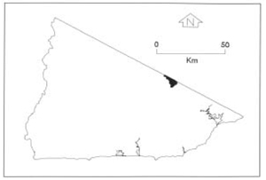 |
Soils: Dominant: Gn3.11, Gn3.71, Um, Uc. Shallow to moderately deep brown gradational and uniform medium profiles with varying depth of organic A horizons over weakly to moderately structured subsoils (B horizons). These profiles are generally stony and are found predominantly on upper to mid-slopes.
Minor: Dy3.11, Dr3.11, Gn. Deeper more developed soil profiles on lower slopes particularly in moister areas; drainage depressions. Greater organic matter accumulation in A horizons and B horizons may be mottled.
Native vegetation: Predominantly Dry Sclerophyll Forest with Narrow-leaved Peppermint and/or East Gippsland Peppermint, White Stringybark, Yellow Stringybark, with occasional Silvertop with sparse and stunted growth on crests particularly around rock outcrop. Taller vegetation occurs on the lower slopes in moister areas especially in drainage depressions where Riparian forest is present with Manna Gum and a moister understorey.
Stone/rock outcrop: Moderate to high; particularly on upper slopes, crests and incised drainage lines.
Pans: Nil or not observed.
Land use: Forested (except for rock outcrop). This unit lies within the Coopracambra National Park.
Observed land deterioration: Sheet erosion, creep, minor rock movement.
Susceptibility to land deterioration: Sheet and rill erosion (moderate to high); Gully erosion (moderate to high). Compaction (low to moderate); Waterlogging/Inundation (very low to moderate); Mass movement (moderate to moderately high); Bank erosion (low to moderate).
Sites with laboratory data: Nil
© State of Victoria (Agriculture Victoria) 1996 - .

This work, Victorian Resources Online, is licensed under a Creative Commons Attribution 4.0 licence. You are free to re-use the work under that licence, on the condition that you credit the State of Victoria (Agriculture Victoria) as author, indicate if changes were made and comply with the other licence terms.
The licence does not apply to ‘branding’ or some ‘images or photographs’ that may be owned by third parties. We ask you to seek prior approval to use images using the VRO feedback form. Access to higher quality images can also be provided on request.
This page was last updated on .