
B 3.39 Mountains, Sedimentary, Type 2
MsSm2, MsSh2, MvSm2, MvSh2, SvSm2, SvSh2, SvSv2
Soils: Dominant: Gn3.11, Gn4.11, Dy3, Db2, Dr. Moderately deep to deep red gradational profiles occur in the moister areas strongly structured (especially the B horizon) with loam/clay loam A horizon (15-30 cm depth) over silty clay loam to sandy clay B horizons with occasional influence from surrounding geologies (i.e. quartz) and variable stone content. Yellow, brown and red duplex profiles occur in drier areas, often mottled, hardsetting, with a distinct contrast in texture and structure between the A and B horizons, though there may be a gradation to this stage from shallower profiles.
Minor: Gn4.5, Dy3. Shallow stony profiles hardsetting apart from a loose organic surface horizon. Shallow stony profiles (friable) occur on upper slopes in moister areas.
Native vegetation: Dry Sclerophyll Forest with Silvertop, White Stringybark, Yellow Stringybark, Austral Bracken, Wire Grass and Acacia understorey. Other Stringybark associations and peppermint occur in the drier areas with Wet Sclerophyll Forest Messmate, Narrow-leaved Peppermint, Croajingolong Peppermint and some gums in the moister areas. There are also occurrences of Warm Temperate Rainforest and Riparian Forest in the drainage depressions.
Stone/rock outcrop: Minor to moderate surface stone, particularly on ridgelines, crests and upper slopes.
Pans: Nil or minor occurrence associated with duplex profiles in drier areas.
Land use: Predominantly forested, much within the Coopracambra National Park while the remainder (moister areas) is State Forest and is available for timber production.
Observed land deterioration: Sheet and rill erosion, soil creep.
Susceptibility to land deterioration: Sheet and rill erosion (moderately low to high); Gully erosion (moderate to moderately high); Compaction (low to high); Mass movement (low to moderately high).
Sites with laboratory data: 194.
Page top
| These units lie to the north of the Low hill and Hill map units and are distinguished from these because of their greater relative relief (>300 m) and steep terrain. These units are located adjoining the Mt. Kaye granitic pluton and north of the WB line track within Coopracambra National Park. The soils range from red gradational profiles, generally friable, on lower slopes in moister areas on mid and lower slopes to shallow profiles and deeper structured gradational and duplex (yellow, brown and red) profiles in drier areas (e.g. Coopracambra area). The vegetation generally ranges from Dry Sclerophyll Forest such as Silvertop/Stringybark associations in drier areas to Wet Sclerophyll Forest. Warm Temperate Rainforest and Riparian Forest occur in moister areas, especially in drainage lines. Geology: Ou; Ordovician sediments. Phyllite, siltstones, slates, sandstone. Rainfall: 700-1200 mm per annum. Slope: 32-56%. Dominant landform element: Slope. Minor landform element: Drainage depression. | 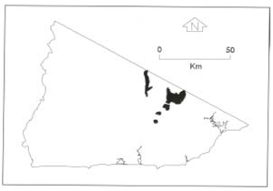 |
Soils: Dominant: Gn3.11, Gn4.11, Dy3, Db2, Dr. Moderately deep to deep red gradational profiles occur in the moister areas strongly structured (especially the B horizon) with loam/clay loam A horizon (15-30 cm depth) over silty clay loam to sandy clay B horizons with occasional influence from surrounding geologies (i.e. quartz) and variable stone content. Yellow, brown and red duplex profiles occur in drier areas, often mottled, hardsetting, with a distinct contrast in texture and structure between the A and B horizons, though there may be a gradation to this stage from shallower profiles.
Minor: Gn4.5, Dy3. Shallow stony profiles hardsetting apart from a loose organic surface horizon. Shallow stony profiles (friable) occur on upper slopes in moister areas.
Native vegetation: Dry Sclerophyll Forest with Silvertop, White Stringybark, Yellow Stringybark, Austral Bracken, Wire Grass and Acacia understorey. Other Stringybark associations and peppermint occur in the drier areas with Wet Sclerophyll Forest Messmate, Narrow-leaved Peppermint, Croajingolong Peppermint and some gums in the moister areas. There are also occurrences of Warm Temperate Rainforest and Riparian Forest in the drainage depressions.
Stone/rock outcrop: Minor to moderate surface stone, particularly on ridgelines, crests and upper slopes.
Pans: Nil or minor occurrence associated with duplex profiles in drier areas.
Land use: Predominantly forested, much within the Coopracambra National Park while the remainder (moister areas) is State Forest and is available for timber production.
Observed land deterioration: Sheet and rill erosion, soil creep.
Susceptibility to land deterioration: Sheet and rill erosion (moderately low to high); Gully erosion (moderate to moderately high); Compaction (low to high); Mass movement (low to moderately high).
Sites with laboratory data: 194.
© State of Victoria (Agriculture Victoria) 1996 - .

This work, Victorian Resources Online, is licensed under a Creative Commons Attribution 4.0 licence. You are free to re-use the work under that licence, on the condition that you credit the State of Victoria (Agriculture Victoria) as author, indicate if changes were made and comply with the other licence terms.
The licence does not apply to ‘branding’ or some ‘images or photographs’ that may be owned by third parties. We ask you to seek prior approval to use images using the VRO feedback form. Access to higher quality images can also be provided on request.
This page was last updated on .