
B 3.37 Mountains, Granitic, Type 4
MHsGh4, MsGm4, MsGh4, MsGv4, MsvGm4, MsvGh4
Soils: Dominant: Gn4.11, Gn3.11, Dy3.11, Dy3.41, Dy3.42, Dy5.14, Dy3.14. Shallow gradational profiles on upper slopes in moister areas (a sandy component throughout); deeper on mid and lower slopes, particularly in areas of colluvial accumulation. Generally organic surface horizons (A horizons) with whole coloured red/brown subsoils (B horizons), grading into paler/yellow parent material. Drier areas generally have Duplex profiles which, if well developed have A2 horizons, generally bleached. These soils have only minor organic surface
horizon and a marked change to a sandy-clay subsoil often grading into parent material.
Minor: There are some shallow coarse Uniform (Uc) profiles close to rock outcrops with variable organic matter content. There are also some soils with organic rich surfaces (A horizon) overlying weathered parent material (C horizon).
Native vegetation: Lowland Sclerophyll Forest is dominant over much of the area with White Stringybark, Yellow Stringybark, Brown Stringybark and Silvertop. Wet Sclerophyll Forest and Dry Sclerophyll Forest occur around Mt. Kaye and further north: Messmate, Narrowleaved Peppermint, Mountain Grey Gum and Brown Barrel with Cassinia spp. as an understorey. The Riparian Forest includes Mountain Grey Gum, Manna Gum, Hazel Pomaderris and Blackwood, the growth and diversity of species being dependent on the moisture status of the area.
Stone/rock outcrop: Moderate where dissected, high on steeper units particular crests and upper slopes.
Pans: Nil or not observed. There may be some pans in deeply weathered parent material.
Land use: These units cover a large forested area, some of which is used for hardwood production. Also, there are units within the Coopracambra National Park including Mt. Coopracambra and a reserve at Winnots Creek. Mt. Kaye has a communications tower (Telecom).
Observed land deterioration: Some sheet and rill erosion, minor gully erosion where disturbed (roads), particularly the lower, colluvial/alluvial slopes.
Susceptibility to land deterioration: Sheet and rill erosion (moderate to very high); Gully erosion (low to moderately high); Compaction (low to high on duplex soils); Mass movement (moderately low to high; steeper units); Wind erosion (very low/low).
Sites with laboratory data: Nil.
Page top
| These units are associated with the designated Noorinbee Granodiorite; north and south of Cann River township. However, the mountain units are confined to north of the Princess Highway and particularly around the Mt. Kay, Mt. Denmarsh area and extending north into New South Wales. Moister areas occur in the vicinity of the plateau to the north and various areas around Mt. Kaye, Mt. Denmarsh and Wombat Hill. Rocky outcrops often occur on crests, particularly the steeps units (MsGm4, MsGh4, MvGm4 and MvGh4) which have large areas of exposed upper slopes and rocky crests (tors). Soil types include shallow organic friable, sandy Gradational profiles, occasionally uniform. Duplex soils occur in drier areas particularly on lower slopes with Gradational and some Duplex profiles in the moister areas. The vegetation is predominantly Lowland Sclerophyll Forest with Dry Sclerophyll Forest and Wet Sclerophyll Forest at higher elevations and other moister locations as well as Riparian Forest. Geology: Dgl4; Devonian Granodiorite (Noorinbee Granodiorite). Rainfall: 700 to greater than 1200 mm per annum. Slope: 32->100%, generally 32-56%. Dominant landform element: Slope, rocky crests (tors). Minor landform element: Drainage depression. | 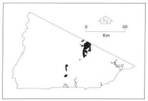 |
Soils: Dominant: Gn4.11, Gn3.11, Dy3.11, Dy3.41, Dy3.42, Dy5.14, Dy3.14. Shallow gradational profiles on upper slopes in moister areas (a sandy component throughout); deeper on mid and lower slopes, particularly in areas of colluvial accumulation. Generally organic surface horizons (A horizons) with whole coloured red/brown subsoils (B horizons), grading into paler/yellow parent material. Drier areas generally have Duplex profiles which, if well developed have A2 horizons, generally bleached. These soils have only minor organic surface
horizon and a marked change to a sandy-clay subsoil often grading into parent material.
Minor: There are some shallow coarse Uniform (Uc) profiles close to rock outcrops with variable organic matter content. There are also some soils with organic rich surfaces (A horizon) overlying weathered parent material (C horizon).
Native vegetation: Lowland Sclerophyll Forest is dominant over much of the area with White Stringybark, Yellow Stringybark, Brown Stringybark and Silvertop. Wet Sclerophyll Forest and Dry Sclerophyll Forest occur around Mt. Kaye and further north: Messmate, Narrowleaved Peppermint, Mountain Grey Gum and Brown Barrel with Cassinia spp. as an understorey. The Riparian Forest includes Mountain Grey Gum, Manna Gum, Hazel Pomaderris and Blackwood, the growth and diversity of species being dependent on the moisture status of the area.
Stone/rock outcrop: Moderate where dissected, high on steeper units particular crests and upper slopes.
Pans: Nil or not observed. There may be some pans in deeply weathered parent material.
Land use: These units cover a large forested area, some of which is used for hardwood production. Also, there are units within the Coopracambra National Park including Mt. Coopracambra and a reserve at Winnots Creek. Mt. Kaye has a communications tower (Telecom).
Observed land deterioration: Some sheet and rill erosion, minor gully erosion where disturbed (roads), particularly the lower, colluvial/alluvial slopes.
Susceptibility to land deterioration: Sheet and rill erosion (moderate to very high); Gully erosion (low to moderately high); Compaction (low to high on duplex soils); Mass movement (moderately low to high; steeper units); Wind erosion (very low/low).
Sites with laboratory data: Nil.
© State of Victoria (Agriculture Victoria) 1996 - .

This work, Victorian Resources Online, is licensed under a Creative Commons Attribution 4.0 licence. You are free to re-use the work under that licence, on the condition that you credit the State of Victoria (Agriculture Victoria) as author, indicate if changes were made and comply with the other licence terms.
The licence does not apply to ‘branding’ or some ‘images or photographs’ that may be owned by third parties. We ask you to seek prior approval to use images using the VRO feedback form. Access to higher quality images can also be provided on request.
This page was last updated on .